Kilmenny
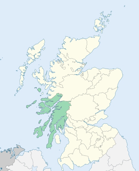
Kilmeny is a parish in the northeast of the island of Islay, Argyleshire. (1867: The Imperial Gazetteer of Scotland, by John Marius Wilson).
Ballygrant, Keills, Port Askaig
PRE-REFORMATION GOVERNANCE:
POST-REFORMATION GOVERNANCE:
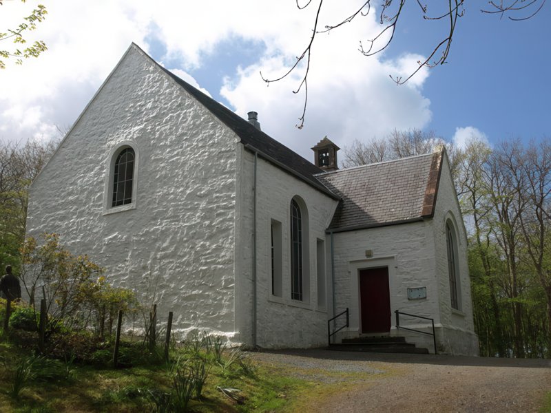
The parish of Kilmeny was united to Kilarrow before 1550. Early in the nineteenth century a parliamentary church was built to take the place of the ancient ruined church of Kilmeny. On 13 May 1849 Kilmeny was disjoined from Kilarrow. In this parish there are mission chapels at Bunnahavain and Caol Ila.
Includes ministers, licentiates, assistants, readers, and clerks.
(1928: Fasti Ecclesiæ Scoticanæ, by Hew Scott, D. D.)
Parish registers turned over to the Registrar-General, as a result of the Registration of Births, Deaths, and Marriages (Scotland) Act of 1854. The letters B. D. and M. indicate Births (or Baptisms), Deaths (or Burials), and Marriages (or Proclamations of Banns) respectively. Numbers indicate separate volumes or books. Note: These records are by no means complete or without damage; consult the Detailed List of the Old Parochial Registers of Scotland (1872) to learn more about the condition of the records.
| OPR and RD Numbers | |||
|---|---|---|---|
| Date Range | Name | Number | Type |
| 1802-1854 | Kilmeny | 543 | OPR |
| 1855-1969 | Kilmeny | 543 | RD |
| 2009 | Argyll and Bute, Islay | 546 | RD |
| 2026 | Argyll and Bute Council; Islay Community Council | ||
(2009: Parishes and Registration Districts of Scotland - Old and New, National Records of Scotland)
Local community councils (2026) are provided as a potential source of additional information for settlements within the original boundaries of the parish. (Source)
Statistics from informal and official censuses
Bates, Blake, Bridgman, Docherty, Dunne, Graham, Keith, Stevenson
By the Reverend Mr John Murdoch, Minister.
"From a late survey, the number of souls in Killarrow, including those in the village, amount to 2500. There are in Kilmeny about 2000. Indeed the whole population of Islay has increased greatly within these 40 years, owing principally to the tenants, who are in possession of large farms, dividing their possessions among their children, which encourages marriage. Some, however, who are reduced in their circumstances, are obliged to emigrate.
The inhabitants are mostly natives of the island, and all belong to the Established Church. They are hospitable, generous, and humane; and, like all islanders, attached to their country."
(This section contains excerpts, at times restructured or paraphrased, from an article appearing in Statistical Account of Scotland, Sir John Sinclair, 1791-1799)
Primary Sources:
Statistical Account of Scotland (1791-1799), Volume 11, p. 298
New Statistical Account of Scotland (1834-1845), Volume 7, Section II, p. 668
See Parish Page Sources for all source information and links.