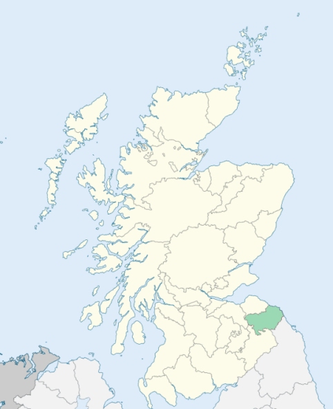
Ladykirk is a parish on the south-eastern border of Berwickshire. It is bounded on the south-east by the River Tweed, which divides it from England, and on other sides by the parishes of Coldstream, Swinton, Whitsome, and Hutton. (1867: The Imperial Gazetteer of Scotland, by John Marius Wilson).
Horndean, Ladykirk, Ramridge, Sheils, Upsetlington
PRE-REFORMATION GOVERNANCE:
POST-REFORMATION GOVERNANCE:
The parishes of Upsettlington and Horndean were united after 1600.
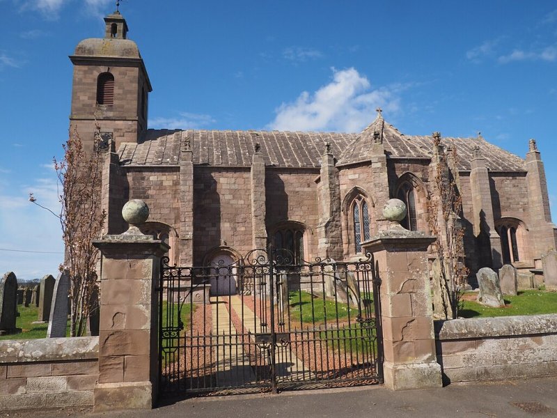
Upsettlington. The church of St Mary at Ladykirk was built by James IV in 1500, as the result of a vow made by him when nearly drowned in the Tweed. It became the parish church of the eastern part of the barony of Upsettlington, the other part, Wester Upsettlington, possessing its own parish church, although this had ceased to exist by the mid-fifteenth century. As the new church became the focal point of the area, the parish was eventually renamed Ladykirk. The church was a meeting-place for the Wardens of the Marches, and the last treaty between Scotland and England was signed within its walls. It was restored in 1743, and again in 1861.
Horndean. The church of Horndean was dedicated by Bishop David de Bernham, 4 April 1243. In the twelfth century Robert Bisset of Upsettlington founded a Hospital of St Leonard near Horndean church.
Includes ministers, licentiates, assistants, readers, and clerks.
(1928: Fasti Ecclesiæ Scoticanæ, by Hew Scott, D. D.)
Parish registers turned over to the Registrar-General, as a result of the Registration of Births, Deaths, and Marriages (Scotland) Act of 1854. The letters B. D. and M. indicate Births (or Baptisms), Deaths (or Burials), and Marriages (or Proclamations of Banns) respectively. Numbers indicate separate volumes or books. Note: These records are by no means complete or without damage; consult the Detailed List of the Old Parochial Registers of Scotland (1872) to learn more about the condition of the records.
| OPR and RD Numbers | |||
|---|---|---|---|
| Date Range | Name | Number | Type |
| 1697-1854 | Ladykirk | 746 | OPR |
| 1855-1957 | Ladykirk | 746 | RD |
| 1958-1958 | Ladykirk and Swinton | 755 | RD |
| 1959-1971 | Ladykirk, Swinton and Whitsome | 755 | RD |
| 1972-1995 | Ladykirk, Swinton and Whitsome | 786 | RD |
| 2009 | (Ladykirk) Scottish Borders, Chirnside | 783 | RD |
| 2009 | (Swinton) Scottish Borders, Coldstream | 787 | RD |
| 2009 | (Whitsome) Scottish Borders, Coldstream | 787 | RD |
| 2026 | (Ladykirk) Scottish Borders Council; Swinton and Ladykirk Community Council | ||
| 2026 | (Swinton) Scottish Borders Council; Swinton and Ladykirk Community Council | ||
| 2026 | (Whitsome) Scottish Borders Council; Allanton, Whitsome and Edrom Community Council | ||
(2009: Parishes and Registration Districts of Scotland - Old and New, National Records of Scotland)
Local community councils (2026) are provided as a potential source of additional information for settlements within the original boundaries of the parish. (Source)
Statistics from informal and official censuses
Barron, Blair, Henderson, Laurie, Paulin, Pike, Robertson, Scott, Whittaker, Wood
Note: Names appearing in research materials, other than censuses. Simple names (First name, surname only) have been omitted unless they appear associated with large properties. All women's names, and men's names with occupations, military ranks, or peerage titles are included.
By the Reverend Mr Thomas Mill.
"The inhabitants have increased considerably within these 40 years. The return to Dr Webster in 1755 was only 386. There are now from 580 to 600. Two years ago the number amounted to 534. The people are mostly employed in husbandry, in raising grain to supply less fertile countries, and in feeding livestock, which are sent commonly to Newcastle, Shields, and Sunderland (Northumberland)."
(This section contains excerpts, at times restructured or paraphrased, from an article appearing in Statistical Account of Scotland, Sir John Sinclair, 1791-1799)
Primary Sources:
Statistical Account of Scotland (1791-1799), Volume 8, p. 462
New Statistical Account of Scotland (1834-1845), Volume 2, Section III, p. 181
See Parish Page Sources for all source information and links.