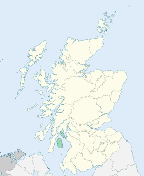
Kingarth is a parish in the island and county of Bute. It comprises the southern part of the island, and is bounded on the north by the parish of Rothesay, and on all other sides by the Firth of Clyde. (1867: The Imperial Gazetteer of Scotland, by John Marius Wilson).
Ascog, Birgidale, Kerrycroy, Kilchattan, Kilchattan Bay, Piper Hall
PRE-REFORMATION GOVERNANCE:
POST-REFORMATION GOVERNANCE:
The church of Kingarth belonged to the Abbey of Paisley. For a time this parish was in the Presbytery of Irvine, but in August 1639 it was transferred to that of Dunoon. In the old churchyard of Kingarth stand the ruins of an ancient Norman church. Beside it is Tobar Bhlaain (Blaan's Well). At the place called Am Margadh na h-Eaglais (the Tryst of the Church), St Blaan's Fair used to be held. In 1680 a new parish church was built on a more central site. In 1826 this latter was replaced by another new church.
Disjoined Quoad Sacra Parishes:
Craigmore. The church was built and opened as a chapel-of-ease 22 December 1889. The parish was disjoined from Rothesay and Kingarth, 21 February 1902.
Includes ministers, licentiates, assistants, readers, and clerks.
Kingarth (QO)
Craigmore (QS)
(1928: Fasti Ecclesiæ Scoticanæ, by Hew Scott, D. D.)
Parish registers turned over to the Registrar-General, as a result of the Registration of Births, Deaths, and Marriages (Scotland) Act of 1854. The letters B. D. and M. indicate Births (or Baptisms), Deaths (or Burials), and Marriages (or Proclamations of Banns) respectively. Numbers indicate separate volumes or books. Note: These records are by no means complete or without damage; consult the Detailed List of the Old Parochial Registers of Scotland (1872) to learn more about the condition of the records.
| OPR and RD Numbers | |||
|---|---|---|---|
| Date Range | Name | Number | Type |
| 1727-1854 | Kingarth | 555 | OPR |
| 1855-1962 | Kingarth | 555 | RD |
| 1968-1971 | Lamlash | 555 | RD |
| 2009 | (Kingarth) Argyll and Bute, Isle of Bute | 550 | RD |
| 2009 | (Lamlash) North Ayrshire, Isle of Arran | 553 | RD |
| 2026 | (Kingarth) Argyll and Bute Council; Bute Community Council | ||
| 2026 | (Lamlash) North Ayrshire Council; Arran Community Council | ||
(2009: Parishes and Registration Districts of Scotland - Old and New, National Records of Scotland)
Local community councils (2026) are provided as a potential source of additional information for settlements within the original boundaries of the parish. (Source)
Statistics from informal and official censuses
Bell, Black, Duncan, Ferguson, Fisher, Martin, Morrison, Shaw, Stewart, Wilson
Note: Names appearing in research materials, other than censuses. Simple names (First name, surname only) have been omitted unless they appear associated with large properties. All women's names, and men's names with occupations, military ranks, or peerage titles are included.
By the Reverend Mr James Thorburn.
"By a list taken in March 1791, the number of the inhabitants is 727. They have decreased 230 within these fifteen years. The reason is, that the town of Rothesay finds employment for day labourers, and other workmen, and afford them higher wages than they can receive in a country parish.
Most of the natives speak English very well; although, in conversing with one another, they seem to be fond of the Gaelic, their mother tongue, which chiefly prevails among the old people, and may have been a hindrance to the more easy and more ready introduction of new methods of improvements in the parish. They are a sober, peaceable, and charitable people."
(This section contains excerpts, at times restructured or paraphrased, from an article appearing in Statistical Account of Scotland, Sir John Sinclair, 1791-1799)
Primary Sources:
Statistical Account of Scotland (1791-1799), Volume 1, p. 308
New Statistical Account of Scotland (1834-1845), Volume 5, Section II, p. 82
See Parish Page Sources for all source information and links.