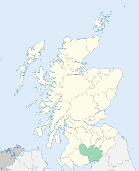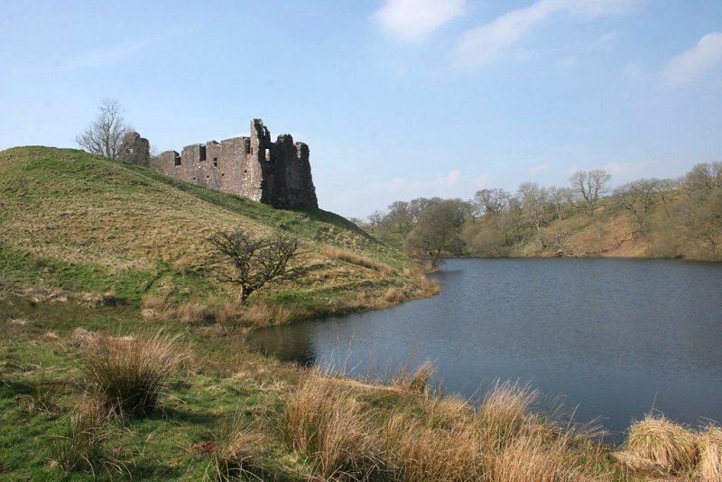
Morton is a parish in the upper part of Nithsdale, Dumfriesshire. It is bounded on the north-east by Lanarkshire, and on other sides by the parishes of Closeburn, Penpont, and Durrisdeer. (1867: The Imperial Gazetteer of Scotland, by John Marius Wilson).
Carron Bridge, East Morton, Drumshinnoch, Gatelawbridge, Greenhead, Hayfield, Morton, Morton Mails, Nithbank, Thornhill
PRE-REFORMATION GOVERNANCE:
POST-REFORMATION GOVERNANCE:
The church belonged to the Abbey of Kelso. Its original site was about a mile and a half from the castle of Morton. In 1841 the Duke of Buccleuch and Queensberry built a new church at Thornhill.
Includes ministers, licentiates, assistants, readers, and clerks.
(1928: Fasti Ecclesiæ Scoticanæ, by Hew Scott, D. D.)
Parish registers turned over to the Registrar-General, as a result of the Registration of Births, Deaths, and Marriages (Scotland) Act of 1854. The letters B. D. and M. indicate Births (or Baptisms), Deaths (or Burials), and Marriages (or Proclamations of Banns) respectively. Numbers indicate separate volumes or books. Note: These records are by no means complete or without damage; consult the Detailed List of the Old Parochial Registers of Scotland (1872) to learn more about the condition of the records.
| OPR and RD Numbers | |||
|---|---|---|---|
| Date Range | Name | Number | Type |
| 1692-1854 | Morton | 843 | OPR |
| 1855-1968 | Morton | 843 | RD |
| 1969-1971 | Thornhill | 843 | RD |
| 1972-2004 | Thornhill | 833 | RD |
| 2005-2009 | Dumfries and Galloway, Thornhill | 833 | RD |
| 2026 | Dumfries & Galloway Council; Thornhill Community Council, Carronbridge Community Council | ||
(2009: Parishes and Registration Districts of Scotland - Old and New, National Records of Scotland)
Local community councils (2026) are provided as a potential source of additional information for settlements within the original boundaries of the parish. (Source)
Statistics from informal and official censuses
Brown, Cook, Hastings, Hyslop, Kerr, Maxwell, Smith, Thomson, Wallace, Wilson
Note: Names appearing in research materials, other than censuses. Simple names (First name, surname only) have been omitted unless they appear associated with large properties. All women's names, and men's names with occupations, military ranks, or peerage titles are included.
By the Reverend Mr John Yorstoun.
"The number of souls in the parish in 1791 was 908, of whom 430 were in Thornhill, and 478 in the country. There were 407 males, 501 females, and 179 under 8 years of age. There were 22 Antiburgher Seceders and 15 Cameronians. A surgeon resides in this parish, whose medical practice extends over a large district of country around.
The village of Thornhill is the only one deserving that name in the parish, though there are two or three more clusters of houses, or as they are vulgarly called, towns, containing from 30 to 50 inhabitants each. Thornhill has greatly increased of late. There were only 325 inhabitants in it in the year 1779. In 1791, they amounted to 430. Labourers and tradesmen find abundance of employment in Thornhill and its neighbourhood; and those who have horses, when not occupied in cultivating their small farms, carry coals from Sanquhar for hire.
In Thornhill there were 6 shopkeepers, 5 farmers, 2 innkeepers, 2 sheriff officers, 2 clockmakers, 2 bakers, 3 masons, 6 cart-wrights and carpenters, 1 wheel-wright, 2 blacksmiths, 1 nailer, 8 shoemakers, 2 weavers, 4 tailors, 1 butcher, 2 carriers, 2 midwives, 24 labourers, 10 male servants, and 11 female servants
In the country part of the parish there were 26 farmers, 1 shopkeeper, 2 millers, 4 masons, 2 cart-wrights, 2 blacksmiths, 9 weavers, 1 cooper, 2 tailors, 15 labourers, 30 male servants, and 33 female servants.
Although this parish is in nearly the same latitude both with Penpont and Holywood, where the people are said to be of an extraordinary stature, yet the inhabitants are, in general, neither above nor below the common size. In their manners and character there is nothing peculiar. They are just as sober and industrious as their neighbours."
(This section contains excerpts, at times restructured or paraphrased, from an article appearing in Statistical Account of Scotland, Sir John Sinclair, 1791-1799)
Primary Sources:
Statistical Account of Scotland (1791-1799), Volume 10, p. 150
New Statistical Account of Scotland (1834-1845), Volume 4, Section I, p. 91
See Parish Page Sources for all source information and links.