Neveth, Rosneveth, Roseneath
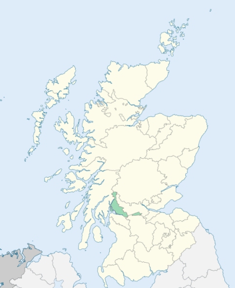
Rosneath is a peninsulated parish in the extreme west of Dunbartonshire. It is connected on the north by an isthmus of 1¼ mile in breadth with the parish of Row, and is bounded on other sides by Gairloch, the Firth of Clyde, and Loch Long. (1867: The Imperial Gazetteer of Scotland, by John Marius Wilson).
Barbour or Barber, Blairnachtra, Coulport, Cove, Kilcreggan, Parkhead, Rahean, Rosneath
Baremman
PRE-REFORMATION GOVERNANCE:
POST-REFORMATION GOVERNANCE:
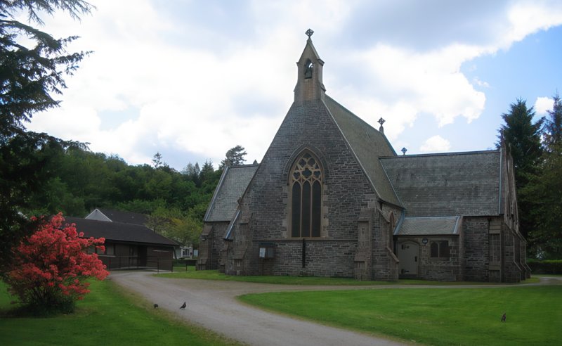
The church of Rosneveth (Ros Neimhidh = the headland of the sanctuary) belonged to the Abbey of Paisley. It was dedicated to St Modan, who dwelt here in early times. An Augustinian Priory, a cell of Cambuskenneth, was founded at Rosneath in the twelfth century. In it St Modan's relics were shown to pilgrims. At Kilcreggan, in the parish, there stood a chapel of St Mary. Rosneath church was rebuilt in 1780, and again in 1853. There is a Mission Chapel at Kilcreggan.
Disjoined Quoad Sacra Parishes:
Craigrownie. The church was opened in February 1853. The parish of Craigrownie was disjoined from Rosneath, 16 March 1864. There is a mission chapel in the parish at Peaton.
Garelochhead. A church was built here in 1838. The parish of Garelochhead was disjoined from Row and Rosneath on 17 March 1873.
Includes ministers, licentiates, assistants, readers, and clerks.
Rosneath (QO)
Craigrownie (QS)
Garelochhead (QS)
(1928: Fasti Ecclesiæ Scoticanæ, by Hew Scott, D. D.)
Parish registers turned over to the Registrar-General, as a result of the Registration of Births, Deaths, and Marriages (Scotland) Act of 1854. The letters B. D. and M. indicate Births (or Baptisms), Deaths (or Burials), and Marriages (or Proclamations of Banns) respectively. Numbers indicate separate volumes or books. Note: These records are by no means complete or without damage; consult the Detailed List of the Old Parochial Registers of Scotland (1872) to learn more about the condition of the records.
| OPR and RD Numbers | |||
|---|---|---|---|
| Date Range | Name | Number | Type |
| 1722-1854 | Rosneath | 502 | OPR |
| 1855-1878 | Rosneath | 502 | RD |
| 1879-1968 | Rosneath | 502-1 | RD |
| 1879-1968 | Kilcreggan and Cove | 502-2 | RD |
| 1969-1971 | Rosneath | 502 | RD |
| 1972-2006 | Rosneath | 502 | RD |
| 2007-2010 | Argyll and Bute, Rosneath | 502 | RD |
| 2026 | (Rosneath) Argyll and Bute Council; Rosneath and Clynder Community Council | ||
| 2026 | (Kilcreggan and Cove) Argyll and Bute Council; Cove and Kilcreggan Community Council | ||
(2009: Parishes and Registration Districts of Scotland - Old and New, National Records of Scotland)
Local community councils (2026) are provided as a potential source of additional information for settlements within the original boundaries of the parish. (Source)
Statistics from informal and official censuses
Anderson, Cameron, Campbell, Chalmers, Clark, Currie, Harvey, Millar, Smith, Stewart
Note: Names appearing in research materials, other than censuses. Simple names (First name, surname only) have been omitted unless they appear associated with large properties. All women's names, and men's names with occupations, military ranks, or peerage titles are included.
By the Reverend Mr George Drummond.
"At present, the number of people is 394, of whom there are 180 males above 10 years, and 160 females above ten years. There are 98 houses in the parish, all which are detached, there being no towns nor villages.
There are 48 farmers, 7 weavers, 1 mason, 3 smiths, 4 shoemakers, 5 tailors, 6 carpenters and apprentices, 6 seamen, 96 herring fishermen, 2 salmon fishermen, 2 ferrymen, and 22 household servants. There are 5 Seceders and 14 Cameronians.
For these 20 years and upwards, no person whatever, residing within this parish, has been imprisoned, except one poor man a short time for a small debt."
(This section contains excerpts, at times restructured or paraphrased, from an article appearing in Statistical Account of Scotland, Sir John Sinclair, 1791-1799)
Primary Sources:
Statistical Account of Scotland (1791-1799), Volume 4, p. 71
New Statistical Account of Scotland (1834-1845), Volume 8, Section I, p. 102
See Parish Page Sources for all source information and links.