
Once upon a time I had the grand idea of creating a Scottish Counties & Surnames section for this site, similar to the Irish Counties & Surnames section. Both of these projects stem from my interest in my personal genealogy, and the desire to help others trace their Scottish, Irish, and Scots-Irish ancestry.
I've learned from working through my family tree that when a brick wall appears, often the only way through it is to research the area where my ancestor lived. Digging deep into records from neighboring counties has unlocked several avenues for me to explore, and ultimately I've been rewarded with little nuggets of information that lowered the brick wall to a less intimidating height.
Through previous projects for my medieval website, work with district tartans in my shops, and as a result of a dream-come-true trip to Scotland, I had a rudimentary understanding of where the historic shires of Scotland were located. I thought I had a pretty good handle on where to start, and a definite plan of attack.
Then I discovered the many boundary and name changes, similar to the forming of new counties in American colonial history, when populations grew and land was annexed from adjacent counties to create a new one. How naive and audacious I felt when I realized what I was up against. But one thing I've discovered about myself over the past 40 years is that I love a deep-dive into scholarly research – so I jumped right in.
Things snowballed quickly. There was no shortage of resources, but there was also plenty of inconsistency and contradiction to work through. It turns out that I'm not the only person overwhelmed by attempting to sort out centuries of boundary changes in Scotland. The Scots themselves drew a line and started over several times.
In the 1700s the Scottish Shires became Counties, and in the 1990s they became Council Areas. Over the years as populations increased (or decreased) boundaries were redrawn - names changed (i.e., Dumfriesshire to Dumfries and Galloway), some were absorbed (Caithness into Highland) and some remained the same. Families that were born, lived, and died in the same location may be recorded as living in different places as those changes occurred over their lifetimes.
For months, I soldiered on, but eventually had to draw a line myself. I decided to concentrate on the earliest information available to me - the OPRs (Old Parochial Registers) and historic shires of Scotland. I created a separate page for each of the OPRs and settled in to work.
In 1855 the Scottish government created the Registrar of Births, Deaths, and Marriages to oversee administration and maintenance of vital records that had previously been maintained by Church of Scotland parish ministers and clerks. The ministers turned over the records that had accumulated in their parishes over the centuries. The Registrar, in order to create an inventory of sorts, assigned a number to each parish. This number is known as the OPR (Old Parochial Registers) number.
The numbers were assigned methodically. They began by arranging the 34 shires starting at the extreme northeast (Shetland) and working their way down through the country in a zigzag fashion to extreme southwest, ending in Wigtownshire. Within each shire they arranged the parishes alphabetically and assigned a number. Any insular parishes (parishes comprised of or located on islands) in the shire were alphabetized and numbered at the end of each list. Thus, Bressay in Shetland is OPR #1, and Wigtown in Wigtownshire is OPR #901.
This worked out well, except for discrepancies that occurred due to some parishes being divided between two (or more) shires, especially the large parishes of Kilmallie (in Argyllshire and Inverness-shire), which was listed in Argyllshire, and Logie (in Perthshire, Clackmannanshire, and Stirlingshire) which was listed in Perthshire but eventually - due to boundary changes - ended up being completely in Stirlingshire.
For the purpose of this project I have listed the parishes in the shires where they were originally assigned, though boundary changes are notated on the individual parish pages.
Since my primary interest - and I believe the majority of my visitors share this interest - relates to the history and genealogy of ancestors from a particular place in Scotland - I have organized this section according to the earliest land demarcations - the Shires.
I have chosen to feature what I feel may be the most important information, in general, to help visitors to this site become more familiar with the area of Scotland where their Scottish ancestors lived. A massive amount of further information is available for free online in the books I've used, and linked to, in this section.
In addition to several geographical dictionaries, all 36 volumes of the two publications of the Statistical Account of Scotland, from the years 1791 and 1845, are free to read online, or to download in PDF format. I've included links on the page where excerpts are quoted, or in some cases, paraphrased or summarized.
These volumes include sections on natural history, flora and fauna, climate, agriculture, the economy, occupations, buildings and ruins, history - both civil and ecclesiastical - and sometimes extensive genealogical data about founders or residents of parishes within the shires.
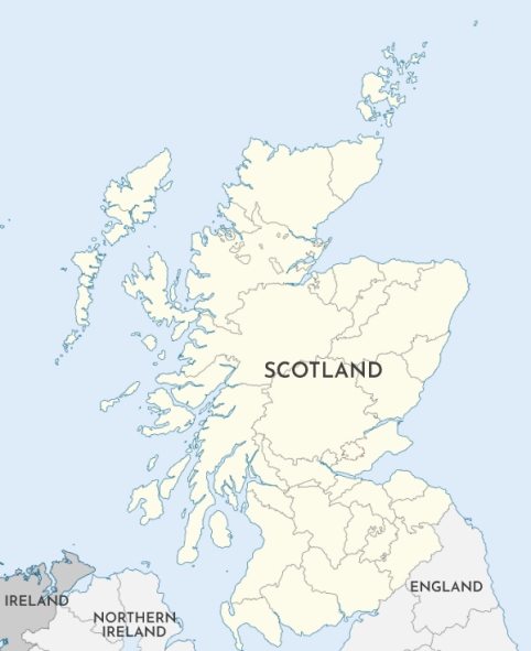
Locations of historic shires
of Scotland.
View more maps at Wikipedia