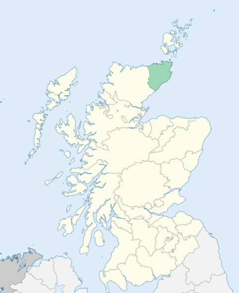
Reay is a parish on the north coast of the counties of Caithness and Sutherland. It is cut lengthwise into two nearly equal parts by the boundary line between the two counties. It is bounded by the German Ocean (North Sea), and by the parishes of Thurso, Halkirk, Kildonan, and Farr. (1867: The Imperial Gazetteer of Scotland, by John Marius Wilson).
Baillie, Borrowstoun or Borrowstown, Lybster, Melvich, Portskerry, Reay, Shebster, Shurrery, Skaill
Sandside
The parish of Reay was situated partly in the county of Caithness and partly in the county of Sutherland. No change was made in the boundary between the counties; but the portion of the parish in the county of Sutherland was disjoined from the parish of Reay and annexed to the parish of Farr, i.e., so much of the old parish of Reay as was situated in the county of Sutherland now forms part of the parish of Farr. Thus the parish of Reay now consists solely of the Caithness-shire part of the old parish. See affected properties and landholders. (1892: Boundary of counties and parishes in Scotland as settled by the Boundary Commissioners under the Local Government Act, 1889, by Hay Shennan)
PRE-REFORMATION GOVERNANCE:
POST-REFORMATION GOVERNANCE:
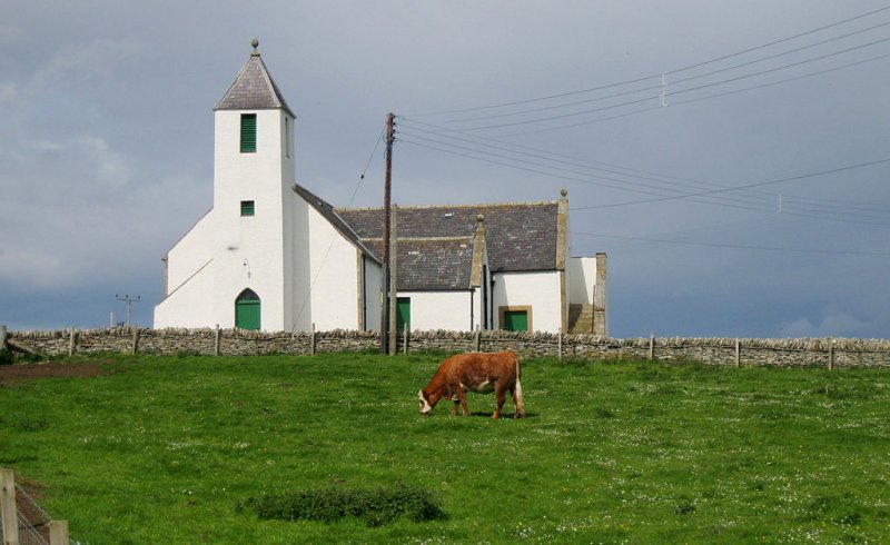
The old church of Reay, dedicated to St Colman, stood at the village of Reay near the seashore. The prebend of Reay, in the Cathedral of Dornoch, belonged to the Bishop of Caithness. There were at least four chapels in this parish, St Mary's and St Peter's, both at Lybster in Reay, St Magnus' at Shebster, and chapels at Skaill and Baillie. A fair of St Colman was held at Reay in December.
Disjoined Quoad Sacra Parishes:
Shurrery. Of old there was at Shurrery a chapel of St Benet. In 1838 William Innes of Sandside built a church and manse here. The parish of Shurrery, disjoined from Reay, Halkirk, and Thurso on 7 March 1902, was endowed by Mr Pilkington of Sandside as a memorial to Lieut. T. D. Pilkington, who fell at Nitrals Nek, South Africa, 11 July 1901.
Includes ministers, licentiates, assistants, readers, and clerks.
Reay (QO)
Shurrery (QS)
(1928: Fasti Ecclesiæ Scoticanæ, by Hew Scott, D. D.)
Parish registers turned over to the Registrar-General, as a result of the Registration of Births, Deaths, and Marriages (Scotland) Act of 1854. The letters B. D. and M. indicate Births (or Baptisms), Deaths (or Burials), and Marriages (or Proclamations of Banns) respectively. Numbers indicate separate volumes or books. Note: These records are by no means complete or without damage; consult the Detailed List of the Old Parochial Registers of Scotland (1872) to learn more about the condition of the records.
| OPR and RD Numbers | |||
|---|---|---|---|
| Date Range | Name | Number | Type |
| 1732-1854 | Reay | 40 | OPR |
| 1855-1967 | Reay | 40 | RD |
| 2009 | Highland; Thurso, Strathy and Mey | 161 | RD |
| 2026 | Highland Council; Caithness West Community Council | ||
(2009: Parishes and Registration Districts of Scotland - Old and New, National Records of Scotland)
Local community councils (2026) are provided as a potential source of additional information for settlements within the original boundaries of the parish. (Source)
Statistics from informal and official censuses
Cameron, Campbell, Fraser, Gunn, Henderson, MacDonald, MacKay, MacLeod, Sinclair, Sutherland
Note: Names appearing in research materials, other than censuses. Simple names (First name, surname only) have been omitted unless they appear associated with large properties. All women's names, and men's names with occupations, military ranks, or peerage titles are included.
By the Reverend Mr David Mackay.
"The people of this parish are on the whole industrious and economical, although, perhaps, rather too much addicted to the drinking of spiritous liquors. They are very hospitable. They are in general poor. It must be confessed, too, that all the attention of the well disposed can hardly restrain the lower classes from pilfering in cases of shipwreck. Recruiting parties in Thurso have frequently picked up young men of this parish for the army. Reay furnished the greater part of two companies of Fencibles during the American War."
(This section contains excerpts, at times restructured or paraphrased, from an article appearing in Statistical Account of Scotland, Sir John Sinclair, 1791-1799)
Primary Sources:
Statistical Account of Scotland (1791-1799), Volume 7, p. 570
New Statistical Account of Scotland (1834-1845), Volume 15, Section II, p. 12
See Parish Page Sources for all source information and links.