Dornoch
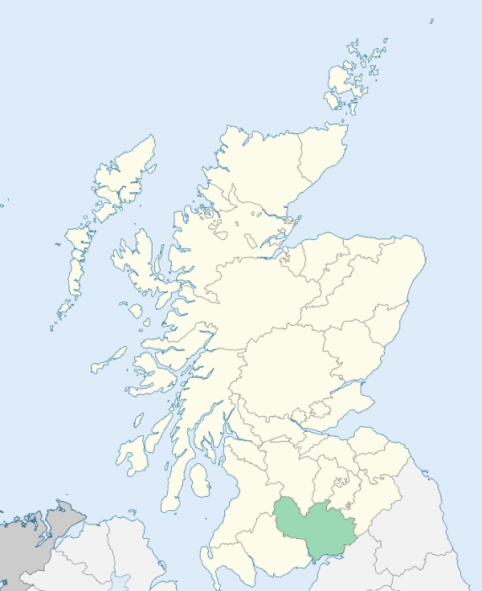
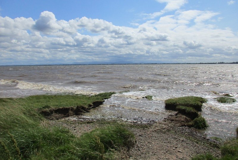
Dornock is a parish on the southern border of Annandale, Dumfriesshire. A small part of it, containing an area of about a square mile, is detached from the main body, and lies about ½ mile to the north, bounded on the west by Annan, and on the other three sides by Kirkpatrick-Fleming. The main body is bounded on the north-east by Kirkpatrick-Fleming, on the east by Gretna, on the south by the Solway Firth, and on the west and north-west by Annan. (1867: The Imperial Gazetteer of Scotland, by John Marius Wilson).
Dornock, Eastriggs, Lowtherton
The parish of Dornock had a detached part situated to the north of the main portion of the parish, and separated from it by an intervening portion of the parish of Kirkpatrick-Fleming. This intervening portion has been transferred to the parish of Dornock, and the main portion of Dornock has thus been united with its detached part. See affected properties and landholders. (1892: Boundary of counties and parishes in Scotland as settled by the Boundary Commissioners under the Local Government Act, 1889, by Hay Shennan)
PRE-REFORMATION GOVERNANCE:
POST-REFORMATION GOVERNANCE:
The church was dedicated to St Marjory. There was an ancient monument here called St Marjory's Cross.
Includes ministers, licentiates, assistants, readers, and clerks.
(1928: Fasti Ecclesiæ Scoticanæ, by Hew Scott, D. D.)
Parish registers turned over to the Registrar-General, as a result of the Registration of Births, Deaths, and Marriages (Scotland) Act of 1854. The letters B. D. and M. indicate Births (or Baptisms), Deaths (or Burials), and Marriages (or Proclamations of Banns) respectively. Numbers indicate separate volumes or books. Note: These records are by no means complete or without damage; consult the Detailed List of the Old Parochial Registers of Scotland (1872) to learn more about the condition of the records.
| OPR and RD Numbers | |||
|---|---|---|---|
| Date Range | Name | Number | Type |
| 1773-1854 | Dornock | 819 | OPR |
| 1855-1968 | Dornock | 819 | RD |
| 2009 | Dumfries and Galloway, Annan | 839 | RD |
| 2026 | Dumfries & Galloway Council; Eastriggs, Dornock and Creca Community Council | ||
(2009: Parishes and Registration Districts of Scotland - Old and New, National Records of Scotland)
Local community councils (2026) are provided as a potential source of additional information for settlements within the original boundaries of the parish. (Source)
Statistics from informal and official censuses
Armstrong, Bell, Bryson, Carruthers, Davidson, Gordon, Irving, Latimer, Richardson, Stewart
Note: Names appearing in research materials, other than censuses. Simple names (First name, surname only) have been omitted unless they appear associated with large properties. All women's names, and men's names with occupations, military ranks, or peerage titles are included.
By the Reverend Mr James Smaill.
"By the examination roll taken about six or seven years ago, this parish contained 780 inhabitants; and about eight or ten years before that, nearly the same number; but by the roll taken in March, 1790, there were only 738 then living, of whom there are 145 under 10 years of age, and 30 Seceders of the Burgher persuasion. Dornock is the only place that can be called a village. It consists of about 25 or 26 dwelling houses.
There are 30 male servants, 28 female servants, and 46 day labourers. Of tradesmen, there are 5 joiners, 4 blacksmiths, 10 weavers, 5 tailors, 5 apprentices, 1 shopkeeper, 1 miller, 1 tidewaiter, 4 public house-keepers, 8 fishermen, who do little else, and about 20 others who fish occasionally.
The inhabitants are in general above the middle size, of clear complexion, agile, and active, and not deficient in mental qualifications. Several of them are above 6 feet high, some about 6 feet, 3 inches. They are inclined to be industrious; but have no manufactory of any consequence to employ them. The people are not very fond of a seafaring life, though some individuals occasionally go to sea. Such young men as enter into the army, seem to give the preference to the artillery.
The people in this parish are naturally sober, active, and industrious. They are greatly more civilized than they were 20 or 30 years ago, particularly since all intercourse of a contraband nature with the Isle of Man has been broken off. They are in general, contented with their situation, though desirous of improving it; and so strict in their conduct and behaviour, that, not only during the incumbency of the present minister, but from time immemorial, not one individual among them has been convicted of a capital crime."
(This section contains excerpts, at times restructured or paraphrased, from an article appearing in Statistical Account of Scotland, Sir John Sinclair, 1791-1799)
Primary Sources:
Statistical Account of Scotland (1791-1799), Volume 2, p. 14
New Statistical Account of Scotland (1834-1845), Volume 4, Section I, p. 256
See Parish Page Sources for all source information and links.