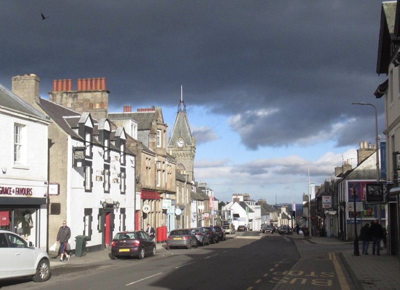
Auchterarder and Aberuthven
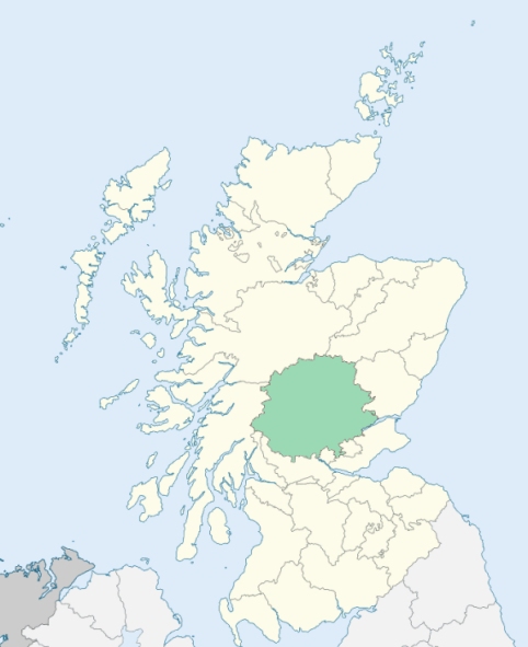
Auchterarder is a parish in the Ochil and Strathearn districts of Perthshire. It is bounded on the west by the parish of Blackford; on the north by Trinity Gask; on the east by Dunning; and on the south by Glendevon. (1867: The Imperial Gazetteer of Scotland, by John Marius Wilson)
Auchterarder, Aberuthven, Auchterardoch, Boreland Park or Borland Park, Castle Park, Smithyhaugh
Cloanden, Damside
PRE-REFORMATION GOVERNANCE:
POST-REFORMATION GOVERNANCE:
The parishes of Auchterarder and Aberuthven were united about the beginning of the seventeenth century.
Auchterarder. The church of Auchterarder, founded in 1200, was dedicated to St Kessog. It belonged to the Abbey of Inchaffray. There was of old, in the town of Auchterarder, a chapel of St Mary. It has been rebuilt, and is now the parish church. Beside the old church a fair of St Kessog was long held on 10th March.
Aberuthven. The church of Aberuthven was dedicated to St Catan, whose festival was held on 17 May. It belonged to the Abbey of Inchaffray, but later to the Abbey of Arbroath.
Includes ministers, licentiates, assistants, readers, and clerks.
Auchterarder (QO)
Aberuthven (QO)
(1928: Fasti Ecclesiæ Scoticanæ, by Hew Scott, D. D.)
Parish registers turned over to the Registrar-General, as a result of the Registration of Births, Deaths, and Marriages (Scotland) Act of 1854. The letters B. D. and M. indicate Births (or Baptisms), Deaths (or Burials), and Marriages (or Proclamations of Banns) respectively. Numbers indicate separate volumes or books. Note: These records are by no means complete or without damage; consult the Detailed List of the Old Parochial Registers of Scotland (1872) to learn more about the condition of the records.
| OPR and RD Numbers | |||
|---|---|---|---|
| Date Range | Name | Number | Type |
| 1661-1854 | Auchterarder | 329 | OPR |
| 1855-1963 | Auchterarder | 329 | RD |
| 1964-1968 | Auchterarder and District | 329 | RD |
| 1969-1971 | Auchterarder | 329 | RD |
| 1972-2003 | Auchterarder | 395 | RD |
| 2009 | Perth and Kinross, Auchterarder | 395 | RD |
| 2026 | Perth and Kinross Council; Auchterarder Community Council | ||
(2009: Parishes and Registration Districts of Scotland - Old and New, National Records of Scotland)
Local community councils (2026) are provided as a potential source of additional information for settlements within the original boundaries of the parish. (Source)
Statistics from informal and official censuses
Anderson, Brown, Campbell, Christie, Dewar, Robertson, Smith, Stewart, Taylor, Young
Note: Names appearing in research materials, other than censuses. Simple names (First name, surname only) have been omitted unless they appear associated with large properties. All women's names, and men's names with occupations, military ranks, or peerage titles are included.
By the Reverend Mr Andrew Duncan.
"The number of people amount at present to 1670 souls, of which 805 are males, and 865 are females; 798 reside in the villages of Auchterarder, Berland-park and Miltown, and 872 in the country. There are 82 farmers and occupiers of land, 49 weavers, 78 mechanics, 109 male servants, and 120 female servants. Besides the Established clergyman, there is one Relief Minister, who resides in the parish, one writer, and one surgeon. The number of souls in the Established Church is 1176, and of Seceders, including those of the Relief persuasion, 492; there are only two Episcopalians.
The people are, in general, much disposed to industry. They are economical, and yet, in general, by no means disinclined to humane and charitable actions."
(This section contains excerpts, at times restructured or paraphrased, from an article appearing in Statistical Account of Scotland, Sir John Sinclair, 1791-1799)
Primary Sources:
Statistical Account of Scotland (1791-1799), Volume 4, p. 33
New Statistical Account of Scotland (1834-1845), Volume 10, p. 285
See Parish Page Sources for all source information and links.