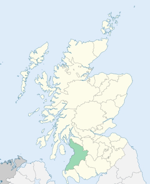
Largs is a parish in the extreme north-west of Cunningham, Ayrshire. It is bounded by the Firth of Clyde, by Renfrewshire, and by the parishes of Kilbirnie, Dalry, and West Kilbride. (1867: The Imperial Gazetteer of Scotland, by John Marius Wilson).
Fairlie or Fairley, Largs, Meigle, SKelmorlie
Brisbane, Curling Hall
PRE-REFORMATION GOVERNANCE:
POST-REFORMATION GOVERNANCE:
The vicarage of Largs belonged to the Abbey of Paisley. Its church was dedicated to St Columba. In early times, the lands now forming the parish of Cumbrae, and a considerable extent of what is now that of West Kilbride, were included in this parish. In 1812 the church of Largs was transferred to a new site, and in 1832 additions and alterations were made upon the church then built. St Colum's Fair, a well-known tryst, has been held at Largs from of old. It used to take place on St Columba's Day, the 9th of June, but in later times the fair day has been changed to the second Tuesday of June. About half-way between Largs and Skelmorlie is St Fillan's Well, and near it once stood St Fillan's Chapel.
Disjoined Quoad Sacra Parishes:
Fairlie. A church was built in 1833. In 1835, a chapel constitution was granted, and a district assigned. The parish was disjoined from Largs and West Kilbride, 19 June 1876.
Skelmorlie. The General Assembly granted a constitution to Kelly Bridge Chapel here in 1856. The parish was disjoined from Inverkip and Largs, 18 July 1860. There was at Skelmorlie a Well of St Fillan.
Includes ministers, licentiates, assistants, readers, and clerks.
Largs (QO)
Fairlie (QS)
Skelmorlie (QS)
(1928: Fasti Ecclesiæ Scoticanæ, by Hew Scott, D. D.)
Parish registers turned over to the Registrar-General, as a result of the Registration of Births, Deaths, and Marriages (Scotland) Act of 1854. The letters B. D. and M. indicate Births (or Baptisms), Deaths (or Burials), and Marriages (or Proclamations of Banns) respectively. Numbers indicate separate volumes or books. Note: These records are by no means complete or without damage; consult the Detailed List of the Old Parochial Registers of Scotland (1872) to learn more about the condition of the records.
| OPR and RD Numbers | |||
|---|---|---|---|
| Date Range | Name | Number | Type |
| 1723-1854 | Largs | 602 | OPR |
| 1855-1896 | Largs | 602 | RD |
| 1897-1968 | Largs | 602-1 | RD |
| 1897-1968 | Skelmorlie | 602-2 | RD |
| 1969-1971 | Largs | 602 | RD |
| 1972-2004 | Largs | 660 | RD |
| 2006-2008 | Largs, North Ayrshire | 660 | RD |
| 2009 | North Ayrshire, Largs | 660 | RD |
| 2026 | (Largs) North Ayrshire Council; Largs Community Council | ||
| 2026 | (Skelmorlie) North Ayrshire Council; Skelmorlie Community Council | ||
(2009: Parishes and Registration Districts of Scotland - Old and New, National Records of Scotland)
Local community councils (2026) are provided as a potential source of additional information for settlements within the original boundaries of the parish. (Source)
Statistics from informal and official censuses
Anderson, Boyd, Brown, Campbell, Crawford, Jack, Morris, Stewart, Watson, Wilson
Note: Names appearing in research materials, other than censuses. Simple names (First name, surname only) have been omitted unless they appear associated with large properties. All women's names, and men's names with occupations, military ranks, or peerage titles are included.
By the Reverend Mr Gilbert Lang.
"The population of the parish, anno 1790, was 805, of whom 389 were males, and 416 females. In the village of Largs there were 243 men, 259 women, in all 502. In the village there are 1 surgeon, 70 weavers, 13 carpenters, 7 cordwainers, 8 tailors, 6 smiths, 6 coopers, 5 masons, 7 sailors, 2 butchers, 1 innkeeper, and 2 carriers. In the village of Fairly there is 1 innkeeper, 1 tailor, 6 weavers, 4 carpenters, 1 smith, 1 cooper, 2 shoemakers, and 5 sailors.
Fishing has been much less attended to, than it ought to be. There are several corn-merchants, who buy grain in Bute and Cumbraes; and also import if from the south of Scotland, and from Ireland. There is no smuggling worth the mentioning, unless the pitiful and occasional help given to the poor seamen, in their little adventures, can be called such.
The inhabitants, in general, are a quiet, sober, decent people. Living chiefly among themselves, they are strangers, and so far, perhaps, happy strangers, to the more free and licentious manners of the world around them."
(This section contains excerpts, at times restructured or paraphrased, from an article appearing in Statistical Account of Scotland, Sir John Sinclair, 1791-1799)
Primary Sources:
Statistical Account of Scotland (1791-1799), Volume 17, p. 503
New Statistical Account of Scotland (1834-1845), Volume 5, Section I, p. 786
See Parish Page Sources for all source information and links.