Inverugie, Longley
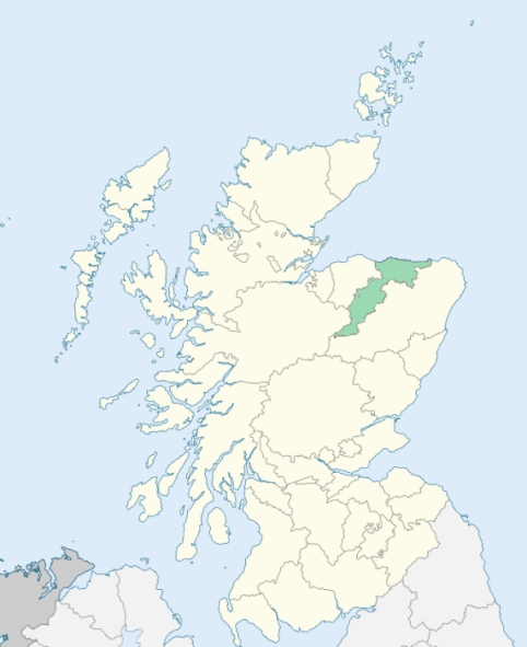
St Fergus is a coastal parish of Buchan, northeast Aberdeenshire. It is bounded on the northwest and north by Crimond; on the east by the German Ocean (North Sea); on the south by Peterhead, and on the southwest by Longside and Lonmay. Until 1891 it formed a detached part of Banffshire. (1892-6: Ordnance Gazetteer of Scotland, by Francis H. Groome)
Annachie, Blackwater, Blackmyres, Blackwater, Cairnmoss, Dipplebrae, Drennes or Drinnes, Ednie, Essie, Inverugie, Inverkenzie, Kirktown, Pitburn, Pittenheath, St Fergus, Shielhill, Skepletown
Part of the parish of New Machar, part of the parish of Old Deer, and the whole of the parish of St Fergus formed detached parts of the county of Banff surrounded by the county of Aberdeen. These detached parts have all been transferred to the county of Aberdeen. See affected properties and landholders. (1892: Boundary of counties and parishes in Scotland as settled by the Boundary Commissioners under the Local Government Act, 1889, by Hay Shennan)
PRE-REFORMATION GOVERNANCE:
POST-REFORMATION GOVERNANCE:
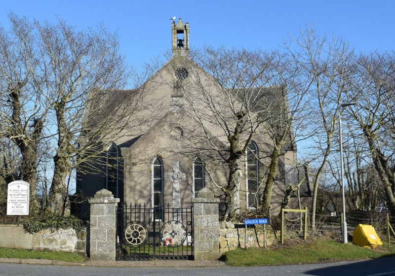
The church of Inverugie was dedicated to St Fergus. It belonged to the Abbey of Arbroath.
Includes ministers, licentiates, assistants, readers, and clerks.
(1928: Fasti Ecclesiæ Scoticanæ, by Hew Scott, D. D.)
Parish registers turned over to the Registrar-General, as a result of the Registration of Births, Deaths, and Marriages (Scotland) Act of 1854. The letters B. D. and M. indicate Births (or Baptisms), Deaths (or Burials), and Marriages (or Proclamations of Banns) respectively. Numbers indicate separate volumes or books. Note: These records are by no means complete or without damage; consult the Detailed List of the Old Parochial Registers of Scotland (1872) to learn more about the condition of the records.
| OPR and RD Numbers | |||
|---|---|---|---|
| Date Range | Name | Number | Type |
| 1688-1854 | St Fergus | 166 | OPR |
| 1855-1892 | St Fergus | 166 | RD |
| 1893-1967 | St Fergus | 237c | RD |
| 2009 | Aberdeenshire, Peterhead | 313 | RD |
| 2026 | Aberdeenshire Council; Buchan East Community Council | ||
(2009: Parishes and Registration Districts of Scotland - Old and New, National Records of Scotland)
Local community councils (2026) are provided as a potential source of additional information for settlements within the original boundaries of the parish. (Source)
Statistics from informal and official censuses
Anderson, Bruce, Milne, Moir, Park, Reid, Ross, Simpson, Smith, Will
Note: Names appearing in research materials, other than censuses. Simple names (First name, surname only) have been omitted unless they appear associated with large properties. All women's names, and men's names with occupations, military ranks, or peerage titles are included.
By the Reverend Mr John Craigie, Minister.
"The number of souls in 1793 is 1240, of whom 559 are male, and 681 female. There are 181 farmers, 2 shopkeepers, 43 weavers, 7 smiths, 12 wrights and coopers, 5 shoemakers, 5 tailors, 3 masons, 2 innkeepers, and 6 masons. The dialect called broad Buchans is spoken here. It is thought to approach nearer to the ancient Gaelic, than the language of any other district in Scotland.
The people in general are very hospitable, kind to strangers, intelligent and contented. They have such an attachment to their native soil, that few of them choose to leave it. From Buchan there never were any emigrations, and indeed there can be no reason for any, as every man, who is disposed to work, can always have good employment and good wages, either as a mechanic or a labourer.
The food of the inhabitants formerly consisted chiefly of oat meal, and sometimes of fish, but these generally salted and dried; owing to this cause, the scurvy was a common disease. They raised few vegetables, and turnips were often brought by sea from Aberdeen. Every cottager now has his turnips, cabbages, potatoes; and many of the farmers have their mutton, fed by themselves for summer food, and the greatest part of them kill a fed ox or cow, for winter provision."
(This section contains excerpts, at times restructured or paraphrased, from an article appearing in Statistical Account of Scotland, Sir John Sinclair, 1791-1799)
Primary Sources:
Statistical Account of Scotland (1791-1799), Volume 15, p. 134
New Statistical Account of Scotland (1834-1845), Volume 12, Section I, p. 185
See Parish Page Sources for all source information and links.