Arroquhar
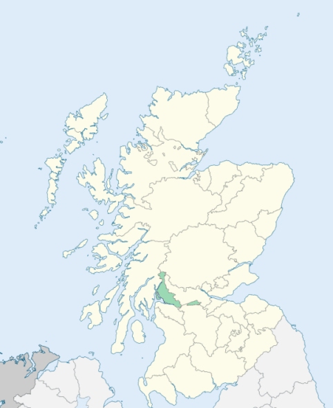
Arrochar is a parish in the north-west corner of Dunbartonshire. It is bounded on the north by Strathfillan in Perthshire, on the east by Perthshire and Loch Lomond to Nether Inveruglass, on the south by the parish of Luss, from which it is separated by the Douglas Burn, and on the west by the upper part of Loch Long, and Argyleshire. (1867: The Imperial Gazetteer of Scotland, by John Marius Wilson).
Ardlui, Ardmay, Arrochar, Inverarnan, Inverbeg, Tarbet
PRE-REFORMATION GOVERNANCE:
POST-REFORMATION GOVERNANCE:
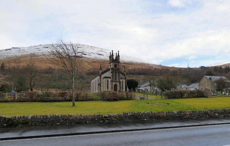
The parish of Arrochar was disjoined from Luss in 1658. Arrochar Church was rebuilt in 1733, and again in 1847. There is a mission chapel within the bounds at Ardlui.
Includes ministers, licentiates, assistants, readers, and clerks.
(1928: Fasti Ecclesiæ Scoticanæ, by Hew Scott, D. D.)
Parish registers turned over to the Registrar-General, as a result of the Registration of Births, Deaths, and Marriages (Scotland) Act of 1854. The letters B. D. and M. indicate Births (or Baptisms), Deaths (or Burials), and Marriages (or Proclamations of Banns) respectively. Numbers indicate separate volumes or books. Note: These records are by no means complete or without damage; consult the Detailed List of the Old Parochial Registers of Scotland (1872) to learn more about the condition of the records.
| OPR and RD Numbers | |||
|---|---|---|---|
| Date Range | Name | Number | Type |
| 1759-1854 | Arrochar | 492 | OPR |
| 1855-1971 | Arrochar | 492 | RD |
| 1972-2006 | Arrochar | 500 | RD |
| 2007-2008 | Arrochar, Argyll and Bute | 500 | RD |
| 2009 | Argyll and Bute, Arrochar | 500 | RD |
| 2026 | Argyll and Bute Council; Arrochar and Tarbet Community Council | ||
(2009: Parishes and Registration Districts of Scotland - Old and New, National Records of Scotland)
Local community councils (2026) are provided as a potential source of additional information for settlements within the original boundaries of the parish. (Source)
Statistics from informal and official censuses
Cameron, Campbell, Carmichael, Clark, Douglas, Keir, Kennedy, MacFarlane, Sinclair, Stewart
Note: Names appearing in research materials, other than censuses. Simple names (First name, surname only) have been omitted unless they appear associated with large properties. All women's names, and men's names with occupations, military ranks, or peerage titles are included.
By the Reverend Mr John Gillespie, Minister of the Parish.
"In the month of March 1791, there were living in the parish of Arroquhar 379 persons, of whom there were 105 under 10 years of age. The small tenants and cottagers find employment, either in repairing the high roads along with the military, building dykes, manufacturing timber and barks in woods, or at the herring fishing, which they generally attend, from the beginning of harvest till New Year's day. Both the Gaelic and English languages are spoken here. The former is most prevalent, and is best understood, particularly by the old people.
The greater part of the people in the parish are MacFarlanes, who have always had, till of late, a strong attachment to the laird, as their chief; and while this subsisted, misanthropy and ferocity of manners were prominent features in their character. Several circumstances, however have occurred, to destroy the influence of the feudal system in this place. The military roads, which were made after the year 1745, opened a free communication with other parts of the kingdom, and an intercourse with strangers. The consequence of this was, that the mind expanded by degrees, to embrace, within its grasp, people of other denominations, and to weaken that prejudice which it conceived in favour of an individual, and a particular clan. The settlement of some graziers here, from the low country, contributed likewise to produce those happy effect. They were at first considered by the natives as aliens, and invaders of property, to which they had no natural right, being neither lineal descendents, nor collateral branches of the MacFarlane race. Such was their antipathy to their new neighbours, that they made several abortive attempts to extirpate them. This, however, gradually subsided, and they lived together afterwards in habits of friendship. They are now civil, well bred, honest, industrious, and not addicted to an immoderate use of spirituous liquors."
(This section contains excerpts, at times restructured or paraphrased, from an article appearing in Statistical Account of Scotland, Sir John Sinclair, 1791-1799)
Primary Sources:
Statistical Account of Scotland (1791-1799), Volume 3, p. 430
New Statistical Account of Scotland (1834-1845), Volume 8, Section I, p. 94
See Parish Page Sources for all source information and links.