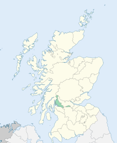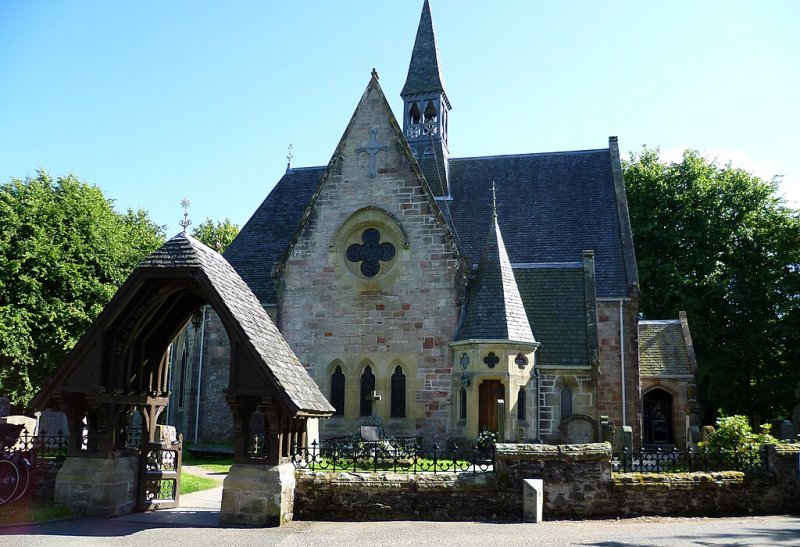
Luss is a parish in Dunbartonshire. It is bounded on the north by Arrochar, on the east by Loch Lomond, on the south by Bonhill and Cardross, and on the west by Row and Loch Long. (1867: The Imperial Gazetteer of Scotland, by John Marius Wilson).
Bannachra or Bennchara, Dunfin, Inveruglas, Luss
Rossdhu
PRE-REFORMATION GOVERNANCE:
POST-REFORMATION GOVERNANCE:
The church of Luss was dedicated to St Kessog. It was a prebend of Glasgow. The island of Innistavannach in Loch Lomond, within this parish, was the dwelling-place of St Kessog. In later times there was a chapel there, which gave the place its name of Innis tigh a'Mhanaich (the Monk's house isle). Besides St Kessog's Chapel at Innistavannach, there were two others in the parish - St Mary's at Rossdhu, where St Kessog was buried, and St Michael's in Glen Luss. In 1315 Robert I granted to St Kessog's Church of Luss a right of sanctuary extending three miles every way, by land and water, around the church.
Includes ministers, licentiates, assistants, readers, and clerks.
(1928: Fasti Ecclesiæ Scoticanæ, by Hew Scott, D. D.)
Parish registers turned over to the Registrar-General, as a result of the Registration of Births, Deaths, and Marriages (Scotland) Act of 1854. The letters B. D. and M. indicate Births (or Baptisms), Deaths (or Burials), and Marriages (or Proclamations of Banns) respectively. Numbers indicate separate volumes or books. Note: These records are by no means complete or without damage; consult the Detailed List of the Old Parochial Registers of Scotland (1872) to learn more about the condition of the records.
| OPR and RD Numbers | |||
|---|---|---|---|
| Date Range | Name | Number | Type |
| 1698-1854 | Luss | 499 | OPR |
| 1855-1968 | Luss | 499 | RD |
| 2009 | West Dunbartonshire, Alexandria | 503 | RD |
| 2026 | West Dunbartonshire Council; Alexandria Community Council | ||
(2009: Parishes and Registration Districts of Scotland - Old and New, National Records of Scotland)
Local community councils (2026) are provided as a potential source of additional information for settlements within the original boundaries of the parish. (Source)
Statistics from informal and official censuses
Aitken, Bennett, Buchanan, Cameron, Campbell, Clark, Grant, Phillips, Stewart, Walker
Note: Names appearing in research materials, other than censuses. Simple names (First name, surname only) have been omitted unless they appear associated with large properties. All women's names, and men's names with occupations, military ranks, or peerage titles are included.
By the Reverend Mr John Stuart, Minister.
"The population in March 1793 was 917 souls. There were 132 families, 448 males, 469 females, of whom 203 were under 8 years of age. There were 915 members of the Established church, and 2 Seceders.
There were 76 farmers, 9 innkeepers and retailers of spirits, ale, &c., 3 shopkeepers, 2 smiths, 2 masons, 7 carpenters and joiners, 4 coopers, 3 corn-millers, 1 lint-miller, 1 flax-dresser, 11 weavers, 3 tailors, 4 shoemakers, 18 journeymen and apprentices to weavers, tailors, and shoemakers, 38 male servants, and 47 female servants.
In 1790, a cotton-mill was erected near the village of Luss. From 30 to 40 hands, young and old, have been usually employed in it. A thread manufacture, upon a small scale, is likewise carried on at Dunfin, near the south end of the parish.
The people, in general, are sober and industrious, humane and charitable. They are regular in their attendance on the ordinances of religion."
(This section contains excerpts, at times restructured or paraphrased, from an article appearing in Statistical Account of Scotland, Sir John Sinclair, 1791-1799)
Primary Sources:
Statistical Account of Scotland (1791-1799), Volume 17, p. 238
New Statistical Account of Scotland (1834-1845), Volume 8, Section I, p. 155
See Parish Page Sources for all source information and links.