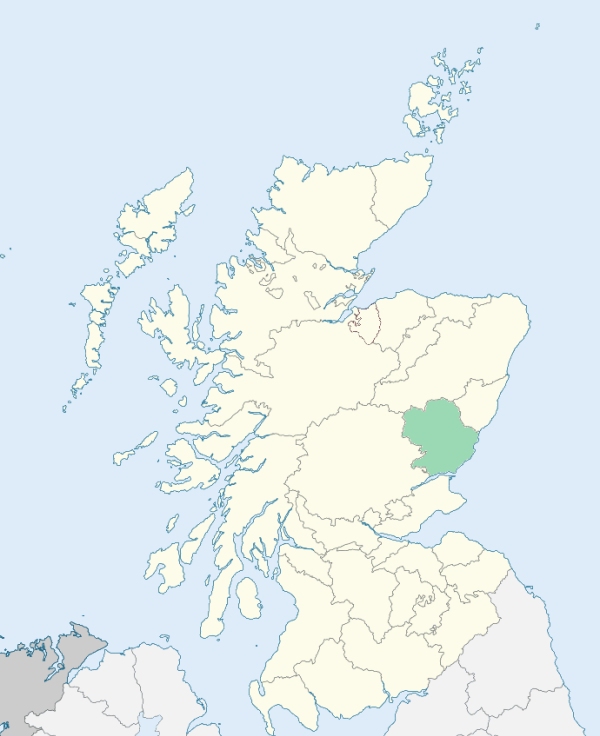
Glenisla is a highland parish in the north-western extremity of Forfarshire. It is bounded by the counties of Perth and Aberdeen, and by the parishes of Clova, Kirriemuir, Lintrathen, and Alyth. (1867: The Imperial Gazetteer of Scotland, by John Marius Wilson).
Auchinleish, Dalhally, Dalvanie, Delnamer, Folda, Freuchies, Glenisla, Kirkton, Linns
PRE-REFORMATION GOVERNANCE:
POST-REFORMATION GOVERNANCE:
The church of Glenisla was dedicated to St Mary, and near it was Our Lady's Well. Glenisla was a prebend of Brechin.
Disjoined Quoad Sacra Parishes:
Kilry. The parish of Kilry was disjoined from Glenisla, Lintrathen, and Alyth on 14th July 1879.
Includes ministers, licentiates, assistants, readers, and clerks.
Glenisla (QO)
Kilry (QS)
(1928: Fasti Ecclesiæ Scoticanæ, by Hew Scott, D. D.)
Parish registers turned over to the Registrar-General, as a result of the Registration of Births, Deaths, and Marriages (Scotland) Act of 1854. The letters B. D. and M. indicate Births (or Baptisms), Deaths (or Burials), and Marriages (or Proclamations of Banns) respectively. Numbers indicate separate volumes or books. Note: These records are by no means complete or without damage; consult the Detailed List of the Old Parochial Registers of Scotland (1872) to learn more about the condition of the records.
| OPR and RD Numbers | |||
|---|---|---|---|
| Date Range | Name | Number | Type |
| 1719-1854 | Glenisla | 290 | OPR |
| 1855-1971 | Glenisla | 290 | RD |
| 1972-1984 | Glenisla | 360 | RD |
| 2009 | Angus, Kirriemuir | 361 | RD |
| 2026 | Angus Council, Kirriemuir Landward West Community | ||
(2009: Parishes and Registration Districts of Scotland - Old and New, National Records of Scotland)
Local community councils (2026) are provided as a potential source of additional information for settlements within the original boundaries of the parish. (Source)
Statistics from informal and official censuses
Cargill, Farquharson, Gow, Jack, Low, Milne, Mitchell, Robertson, Stewart, Wilson
Note: Names appearing in research materials, other than censuses. Simple names (First name, surname only) have been omitted unless they appear associated with large properties. All women's names, and men's names with occupations, military ranks, or peerage titles are included.
By the Reverend Mr James Donald.
"On the 12th of July 1791, there were living in the parish 1018 souls; of whom 224 were under 10 years of age, 456 between 10 and 20, and 338 widowers and married. The greater part of the inhabitants have small farms, with a considerable extent of pasturage annexed to them. About 54 of them are small proprietors or portioners, and great part of these occupy their lands themselves. There are just now in the parish 3 blacksmiths, 8 weavers, 7 tailors, and 4 wrights. What is remarkable, there is not a shoemaker in the parish. All the inhabitants are of the established church excepting 8 Non-jurors, 5 Catholics, and 1 Burgher Seceder.
The general character of the people is, that they are humane, and when they form an attachment to a person, will exert their utmost efforts to serve him. They are not indeed so industrious as could be wished. The summer months are mostly spent in providing fuel and tending the flocks; while the winter months are mostly consumed in burning this fuel. With respect to their morals, they are punctual in attending on public worship, and as decent in their behaviour in other respects, as their neighours around them."
(This section contains excerpts, at times restructured or paraphrased, from an article appearing in Statistical Account of Scotland, Sir John Sinclair, 1791-1799)
Primary Sources:
Statistical Account of Scotland (1791-1799), Volume 6, p. 390
New Statistical Account of Scotland (1834-1845), Volume 11, Section I, p. 421
See Parish Page Sources for all source information and links.