Muirhouse
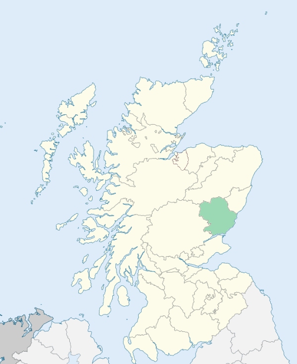
Murroes is an inland parish in the south of Forfarshire. It is bounded by Inverarity, Monikie, Monifieth, Dundee, Mains, and Tealing. (1867: The Imperial Gazetteer of Scotland, by John Marius Wilson).
Brighty, Bucklerhead, Burnside of Duntrune, Hole of Murroes, Kellas
Ballumbie, Powrie
The parish of Dundee had a detached part situated at Duntrune, and almost surrounded by the parish of Murroes. It has been transferred to Murroes. See affected properties and landholders. (1892: Boundary of counties and parishes in Scotland as settled by the Boundary Commissioners under the Local Government Act, 1889, by Hay Shennan)
PRE-REFORMATION GOVERNANCE:
POST-REFORMATION GOVERNANCE:
The church of Murroes belonged to the Abbey of Arbroath.
Includes ministers, licentiates, assistants, readers, and clerks.
Murroes (QO)
Ballumbie (QO)
(1928: Fasti Ecclesiæ Scoticanæ, by Hew Scott, D. D.)
Parish registers turned over to the Registrar-General, as a result of the Registration of Births, Deaths, and Marriages (Scotland) Act of 1854. The letters B. D. and M. indicate Births (or Baptisms), Deaths (or Burials), and Marriages (or Proclamations of Banns) respectively. Numbers indicate separate volumes or books. Note: These records are by no means complete or without damage; consult the Detailed List of the Old Parochial Registers of Scotland (1872) to learn more about the condition of the records.
| OPR and RD Numbers | |||
|---|---|---|---|
| Date Range | Name | Number | Type |
| 1698-1854 | Murroes | 313 | OPR |
| 1855-1968 | Murroes | 313 | RD |
| 2009 | Dundee City | 350-353 | RD |
| 2026 | Angus Council; Murroes and Wellbank Community Council | ||
(2009: Parishes and Registration Districts of Scotland - Old and New, National Records of Scotland)
Local community councils (2026) are provided as a potential source of additional information for settlements within the original boundaries of the parish. (Source)
Statistics from informal and official censuses
Brown, Fairweather, Johnston, Milne, Nicoll, Reid, Smith, Stewart, Sturrock, Wilson
Note: Names appearing in research materials, other than censuses. Simple names (First name, surname only) have been omitted unless they appear associated with large properties. All women's names, and men's names with occupations, military ranks, or peerage titles are included.
By the Reverend Mr Alexander Imlach.
"In that part of Easter Gaigie, which is situated in this parish, (a great part of it lying in the parish of Monifieth), there are 32 men and women, and 12 children under 10 years of age; of these men 7 are weavers. In Wester Gaigie, there are 72 men and women, and 20 children; of these are 2 wrights, 5 weavers, and 1 heckler. On the land of Muirhouse, there are 58 men and women, and 11 children; of these are 8 weavers, 2 tailors, 1 mason, 2 smiths, 1 gardener, 2 shoemakers, and 2 millers. In the lands of Wester Powrie, the most extensive estate in the parish, there are 97 men and women, and 38 children; of these 1 miller, 2 smiths, and 5 weavers. On the lands of Wedderburn, or Easter Powrie, 40 men and women, and 26 children; of these 1 smith. On Ballumbie, 26 men and women, and 15 children, 1 weaver. On Westhall, 9 men and women, and 6 children. Total, 344 men and women, and 128 children; in all 462.
They are a sober, regular, and industrious people, and mostly employed in farming, (the few tradesmen already mentioned excepted.) In the parish there is neither brewer nor baker. Within these 30 years, their situation is greatly altered to the better, and I can, with safety, say, that more money has been acquired by farming in this parish, and the vicinity, these 30 years past, than for 200 years before that period; though, at the same time, their mode of living is greatly improved, their houses more comfortable, and better furnished; they even use some of the luxuries in life."
(This section contains excerpts, at times restructured or paraphrased, from an article appearing in Statistical Account of Scotland, Sir John Sinclair, 1791-1799)
Primary Sources:
Statistical Account of Scotland (1791-1799), Volume 13, p. 161
New Statistical Account of Scotland (1834-1845), Volume 11, Section I, p. 591
See Parish Page Sources for all source information and links.