Dealg an Rois (Dalcross)
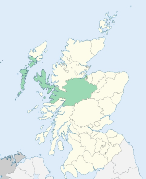
Croy and Dalcross is a united parish in the counties of Nairn and Inverness-shire. Its extreme length is about 21 miles, but it is so intersected by the parishes of Petty, Daviot, and Inverness, that its breadth cannot be exactly ascertained. (1867: The Imperial Gazetteer of Scotland, by John Marius Wilson)
Cantraywood, Clephanton, Croy, Culloden, Dalroy
Cantray, Culloden, Holme or Holme Rose
The parish of Croy & Dalcross was divided between the counties of Inverness and Nairn by a most irregular boundary line. The parish also had a detached part situated in Inverness-shire and forming part of that county. The detached part of the parish was transferred to the parish of Inverness. The parish as thus altered in area by the disjunction of its detached part was redivided between the two counties concerned in such a way as to avoid the inconveniences caused by the former boundary, with the result of leaving the parish pretty equally divided between the county of Inverness and the county of Nairn. There was thus an exchange of areas within the parish between these two counties. See affected properties and landholders. (1892: Boundary of counties and parishes in Scotland as settled by the Boundary Commissioners under the Local Government Act, 1889, by Hay Shennan)
PRE-REFORMATION GOVERNANCE:
POST-REFORMATION GOVERNANCE:
The parishes of Croy and Dalcross were united on 14 July 1618.
Croy. Croy was a prebend of the Cathedral of Elgin. Its church was dedicated to St Duthac. There were chapels in the parish at Cill Dhuaich (St Duthac's), Chapelton, and Kilravock.
Dalcross. The vicarage of Dealg an Rois belonged to the Priory of Urquhart.
Includes ministers, licentiates, assistants, readers, and clerks.
(1928: Fasti Ecclesiæ Scoticanæ, by Hew Scott, D. D.)
Parish registers turned over to the Registrar-General, as a result of the Registration of Births, Deaths, and Marriages (Scotland) Act of 1854. The letters B. D. and M. indicate Births (or Baptisms), Deaths (or Burials), and Marriages (or Proclamations of Banns) respectively. Numbers indicate separate volumes or books. Note: These records are by no means complete or without damage; consult the Detailed List of the Old Parochial Registers of Scotland (1872) to learn more about the condition of the records.
| OPR and RD Numbers | |||
|---|---|---|---|
| Date Range | Name | Number | Type |
| 1719-1854 | Croy and Dalcross | 94 | OPR |
| 1855-1970 | Croy and Dalcross | 94 | RD |
| 2009 | Highland, Inverness | 240 | RD |
| 2026 | Highland Council; Croy and Culloden Moor Community Council | ||
(2009: Parishes and Registration Districts of Scotland - Old and New, National Records of Scotland)
Local community councils (2026) are provided as a potential source of additional information for settlements within the original boundaries of the parish. (Source)
Statistics from informal and official censuses
Cameron, Campbell, Davidson, Forbes, Fraser, Grant, Reid, Robertson, Rose, Ross
Note: Names appearing in research materials, other than censuses. Simple names (First name, surname only) have been omitted unless they appear associated with large properties. All women's names, and men's names with occupations, military ranks, or peerage titles are included.
By the Reverend Mr Hugh Calder, Minister.
"There are in the parish artificers or tradesmen of the different crafts, as masons, carpenters, millers, blacksmiths, weavers, tailors, shoemakers, &c. who are employed by the other inhabitants. But as most of these tradesmen have more or less land, which they cultivate, and on which they depend for part of their living, it would not be easy, in some cases, to determine to which profession they belong. The people, in general, appear satisfied with their condition, though they labour under great disadvantages, namely, the unfavourable quality of the soil on the one hand, and their bad treatment of it on the other."
(This section contains excerpts, at times restructured or paraphrased, from an article appearing in Statistical Account of Scotland, Sir John Sinclair, 1791-1799)
Primary Sources:
Statistical Account of Scotland (1791-1799), Volume 11, p. 560
New Statistical Account of Scotland (1834-1845), Volume 14, Section I, p. 444
See Parish Page Sources for all source information and links.