Machanshire
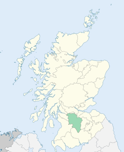
Dalserf is a parish in the centre of the southern border of the middle ward of Lanarkshire. It is bounded by the parishes of Hamilton, Cambusnethan, Carluke, Lesmahagow, and Stonehouse. (1867: The Imperial Gazetteer of Scotland, by John Marius Wilson).
Dalserf, Larkhall, Millheugh, Netherburn, Rosebank
Birkenshaw, Broomhill, Garion
PRE-REFORMATION GOVERNANCE:
POST-REFORMATION GOVERNANCE:
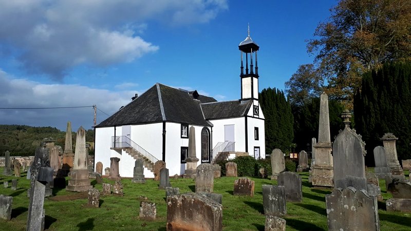
The church of Machanshire was a prebend belonging to the Dean of Glasgow. Its dedication to St Mary had superseded an earlier one to St Machan. There were four chapels within the bounds - St Serf's at Chapelton of Dalserf, St Ronan's at Broomhill, known as Chapel Rone, St Patrick's at Dalpatrick, and the chapel at The Chapel Knowe of Raploch. In 1655 the parish church was removed from St Mary's to Dalserf. There are in the parish mission chapels at Netherburn and the Rorison Memorial.
Disjoined Quoad Sacra Parishes:
Larkhall. A church was first opened here, 10 January 1836. The parish of Larkhall was endowed by William, eleventh Duke of Hamilton, and was disjoined from Dalserf on 5 July 1855. There is in the parish a mission chapel of St Machan.
Includes ministers, licentiates, assistants, readers, and clerks.
Dalserf (QO)
Larkhall (QS)
(1928: Fasti Ecclesiæ Scoticanæ, by Hew Scott, D. D.)
Parish registers turned over to the Registrar-General, as a result of the Registration of Births, Deaths, and Marriages (Scotland) Act of 1854. The letters B. D. and M. indicate Births (or Baptisms), Deaths (or Burials), and Marriages (or Proclamations of Banns) respectively. Numbers indicate separate volumes or books. Note: These records are by no means complete or without damage; consult the Detailed List of the Old Parochial Registers of Scotland (1872) to learn more about the condition of the records.
| OPR and RD Numbers | |||
|---|---|---|---|
| Date Range | Name | Number | Type |
| 1738-1854 | Dalserf | 638 | OPR |
| 1855-1946 | Larkhall | 638-1 | RD |
| 1855-1946 | Dalserf | 638-2 | RD |
| 1947-1968 | Dalserf and Larkhall | 638 | RD |
| 1969-1971 | Larkhall | 638 | RD |
| 1972-2004 | Larkhall | 580 | RD |
| 2005-2008 | Larkhall, South Lanarkshire | 580 | RD |
| 2009 | South Lanarkshire, Larkhall | 580 | RD |
| 2026 | (Dalserf) South Lanarkshire Council; Lower Clyde Valley Community Council | ||
| 2026 | (Larkhall) South Lanarkshire Council; Larkhall Community Council | ||
(2009: Parishes and Registration Districts of Scotland - Old and New, National Records of Scotland)
Local community councils (2026) are provided as a potential source of additional information for settlements within the original boundaries of the parish. (Source)
Statistics from informal and official censuses
Brown, Bruce, Currie, Frame, Hamilton, Scott, Smith, Stewart, Thomson, Wilson
Note: Names appearing in research materials, other than censuses. Simple names (First name, surname only) have been omitted unless they appear associated with large properties. All women's names, and men's names with occupations, military ranks, or peerage titles are included.
By the Reverend Mr John Risk.
"The number of inhabitants in this parish has of late years, been considerably increased, owing chiefly to the increase of the village of Larkhall. In 1755, they amounted to 765 souls, and now to about 1100. Of these there are 100 weavers, 16 masons, 16 joiners and carpenters, 8 shoemakers, 9 tailors, 4 blacksmiths, 4 shopkeepers, 4 millers, 1 surgeon, 1 dyer, 1 spinner on a cotton jeany, 9 innkeepers, and 35 coal miners.
The village of Larkhall has become the largest village in the district, though formerly the most inconsiderable. It consists of about 100 houses, inhabited principally by weavers. There are no less than 4 coal works in the parish, two on the west, one in the center of the parish, and one upon the south."
(This section contains excerpts, at times restructured or paraphrased, from an article appearing in Statistical Account of Scotland, Sir John Sinclair, 1791-1799)
Primary Sources:
Statistical Account of Scotland (1791-1799), Volume 2, p. 371
New Statistical Account of Scotland (1834-1845), Volume 6, p. 719
See Parish Page Sources for all source information and links.