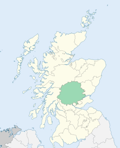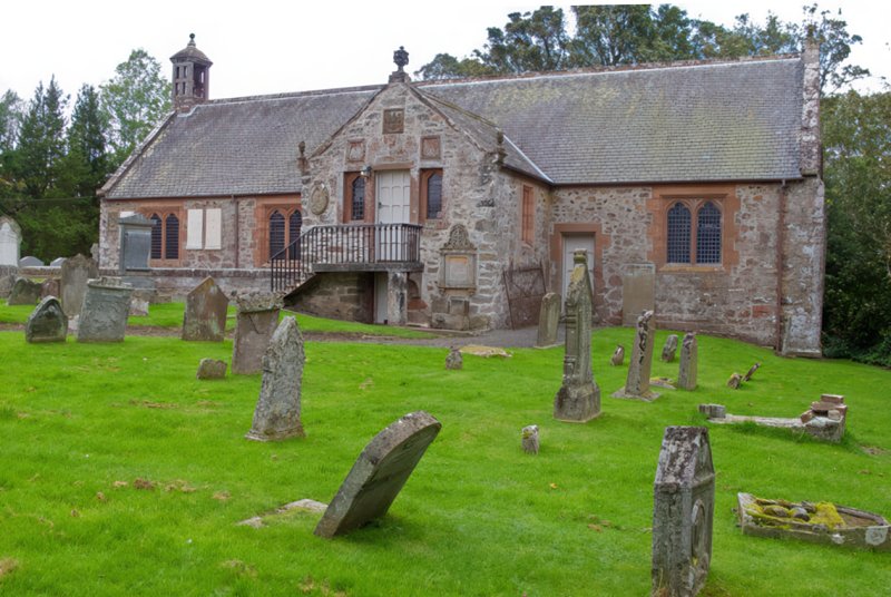
Forgandenny is a parish partly in Kinross-shire, but chiefly in Perthshire. It is bounded on the north by the Earn, which divides it from Aberdalgie and a detached part of Forteviot, on the east by Dunbarney, Dron, and Arngask, on the south by a second detached part of Forteviot, and by Orwell, and on the west by Dunning and the main body of Forteviot. (1867: The Imperial Gazetteer of Scotland, by John Marius Wilson).
Condie, Eastfield, Forgandenny
Ardargie, Condie, Freeland, Invermay, Moncrieffe, Newton or Newtown, Rossie, Rossie Hill
The parish of Forgandenny was situated partly in the county of Kinross and partly in the county of Perth. The Kinross-shire part was transferred to Perthshire, and it was at the same time transferred to the parish of Forteviot. See affected properties and landholders. (1892: Boundary of counties and parishes in Scotland as settled by the Boundary Commissioners under the Local Government Act, 1889, by Hay Shennan)
PRE-REFORMATION GOVERNANCE:
POST-REFORMATION GOVERNANCE:
There was here an ancient dedication to St Devenich. The church of Forgandenny belonged to the Abbey of Inchcolm. This was a mensal parish of the Bishops of Dunkeld. At Forgandenny there was a Chapel of St Katherine, and at Freeland within the bounds there was one dedicated to St Mary. In 1642 the lands of Easter and Wester Fordell, Paris, Deuglie, Blair, Plaines, Glendye, and Glendye Miln were taken off this parish and joined to Arngask.
Includes ministers, licentiates, assistants, readers, and clerks.
(1928: Fasti Ecclesiæ Scoticanæ, by Hew Scott, D. D.)
Parish registers turned over to the Registrar-General, as a result of the Registration of Births, Deaths, and Marriages (Scotland) Act of 1854. The letters B. D. and M. indicate Births (or Baptisms), Deaths (or Burials), and Marriages (or Proclamations of Banns) respectively. Numbers indicate separate volumes or books. Note: These records are by no means complete or without damage; consult the Detailed List of the Old Parochial Registers of Scotland (1872) to learn more about the condition of the records.
| OPR and RD Numbers | |||
|---|---|---|---|
| Date Range | Name | Number | Type |
| 1695-1854 | Forgandenny | 353 | OPR |
| 1855-1965 | Forgandenny | 353 | RD |
| 2009 | Perth and Kinross, Perth | 390 | RD |
| 2026 | Perth and Kinross Council; Earn Community Council | ||
(2009: Parishes and Registration Districts of Scotland - Old and New, National Records of Scotland)
Local community councils (2026) are provided as a potential source of additional information for settlements within the original boundaries of the parish. (Source)
Statistics from informal and official censuses
Carmichael, Chalmers, Christie, Eadie, Haxton, Henderson, Law, Robertson, Stewart, Young
Note: Names appearing in research materials, other than censuses. Simple names (First name, surname only) have been omitted unless they appear associated with large properties. All women's names, and men's names with occupations, military ranks, or peerage titles are included.
By the Reverend Mr Robert Thomas.
"The number of souls, at present, is 978, of which 467 are males, and 511 females. There are no manufacturers who do business to any extent. There are 2 possessors of mills, (of which there are 6 in the parish), who manufacture corn into meal, and sell it in the neighbourhood. And there are two or three people, who, with a servant or two, manufacture linen cloth and shoes, which they sell in Perth. There are no merchants in the parish. The number of handicraftsmen, in which are included some of the manufacturers is 67. There are 13 apprentices, 18 household male and female servants, 98 labouring male and female servants, 23 day labourers, and 4 students at college. There are 257 persons born in other parishes. Those who attend the established church are 731; there are 241 Seceders, and 6 Episcopalians.
The language now spoken is a dialect of the English; but the names of many places seem to indicate, that the Earse, or Gaelic, had formerly been the vulgar language.
There are four villages in the parish, the Newton, Ardargie, the Path of Condie, and Forgan. Newton consists of about 15 dwelling houses; Ardargie contains about 17 or 18 farm houses and cottages; the Path of COndie contains about 22 dwelling-houses, besides a mill, and Antiburgher meeting-house, and a school. The village of Forgan consists of about 30 houses, most of which are inhabited by handicraftsmen and labourers."
(This section contains excerpts, at times restructured or paraphrased, from an article appearing in Statistical Account of Scotland, Sir John Sinclair, 1791-1799)
Primary Sources:
Statistical Account of Scotland (1791-1799), Volume 3, p. 298
New Statistical Account of Scotland (1834-1845), Volume 10, p. 948
See Parish Page Sources for all source information and links.