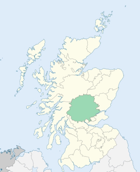
Redgorton is a parish in the Almond and Tay districts of Perthshire. It comprises a detached district and a main body. The detached district is surrounded by Auchtergaven and Logie-Almond. The main body of the parish is bounded by Auchtergaven, Kinclaven, St Martins, Scone, Tibbermore, Methven, and Moneydie. (1867: The Imperial Gazetteer of Scotland, by John Marius Wilson).
Bridgeton, Broxie, Craighead, Cromwell Park, Luncarty, Pitcairn or Pitcairngreen, Redgorton, Stanley, Strathdon, Woodend
Benchill, Lynedoch
PRE-REFORMATION GOVERNANCE:
POST-REFORMATION GOVERNANCE:
The parishes of Redgorton, Luncarty, and Pitcairn were united about 1614.
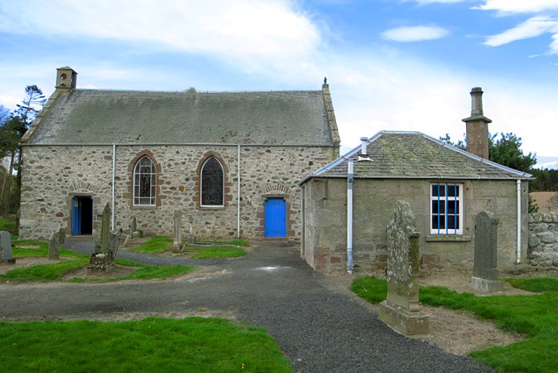
Redgorton. The church of Redgorton was dedicated to St Colin. There was also a later dedication to St Mary. The church belonged to the Abbey of Scone.
Luncarty. The church of Luncarty was dedicated to St Fillan.
Pitcairn. The church of Pitcairn was dedicated to St Serf.
Disjoined Quoad Sacra Parishes:
Stanley. Approved of by General Assembly 29 May 1828 as a Chapel-of-Ease. The parish was disjoined from Auchtergaven, Kinclaven, and Redgorton, and erected by the Court of Teinds, 22 January 1877.
Includes ministers, licentiates, assistants, readers, and clerks.
Redgorton (QO)
Luncarty (QO)
Stanley (QS)
(1928: Fasti Ecclesiæ Scoticanæ, by Hew Scott, D. D.)
Parish registers turned over to the Registrar-General, as a result of the Registration of Births, Deaths, and Marriages (Scotland) Act of 1854. The letters B. D. and M. indicate Births (or Baptisms), Deaths (or Burials), and Marriages (or Proclamations of Banns) respectively. Numbers indicate separate volumes or books. Note: These records are by no means complete or without damage; consult the Detailed List of the Old Parochial Registers of Scotland (1872) to learn more about the condition of the records.
| OPR and RD Numbers | |||
|---|---|---|---|
| Date Range | Name | Number | Type |
| 1706-1854 | Redgorton | 390 | OPR |
| 1855-1933 | Redgorton | 390 | RD |
| 1934-1956 | Redgorton and Moneydie | 390 | RD |
| 2009 | Perth and Kinross, Perth | 390 | RD |
| 2026 | Perth and Kinross Council; Luncarty, Redgorton and Moneydie Community Council | ||
(2009: Parishes and Registration Districts of Scotland - Old and New, National Records of Scotland)
Local community councils (2026) are provided as a potential source of additional information for settlements within the original boundaries of the parish. (Source)
Statistics from informal and official censuses
Anderson, Campbell, Kennedy, Miller, Robertson, Rutherford, Smith, Stewart, Taylor, Young
Note: Names appearing in research materials, other than censuses. Simple names (First name, surname only) have been omitted unless they appear associated with large properties. All women's names, and men's names with occupations, military ranks, or peerage titles are included.
By the Reverend Mr David Moncrieff.
"The number of souls is now 2123, of which 507 are under 10 years of age. There are about 30 weavers, three smithies, and two master house carpenters. There are seven public houses, but three would be perfectly sufficient for every useful purpose. There are no residing heritors, neither are there here any physicians, lawyers, or attorneys.
The work people, employed in the various manufactures, are distinguished from their neighbours by the cleanliness and neatness of their dress, particularly the females, who, upon this account, are generally married very young. There is a sprightliness and vivacity in their manners, which is very engaging; and on all convivial occasions, especially at their weddings, as they are generally taught to dance, they display a gaiety and order which is seldom found in other places."
(This section contains excerpts, at times restructured or paraphrased, from an article appearing in Statistical Account of Scotland, Sir John Sinclair, 1791-1799)
Primary Sources:
Statistical Account of Scotland (1791-1799), Volume 15, p. 523
New Statistical Account of Scotland (1834-1845), Volume 10, p. 562
See Parish Page Sources for all source information and links.