Stornoway and Gress
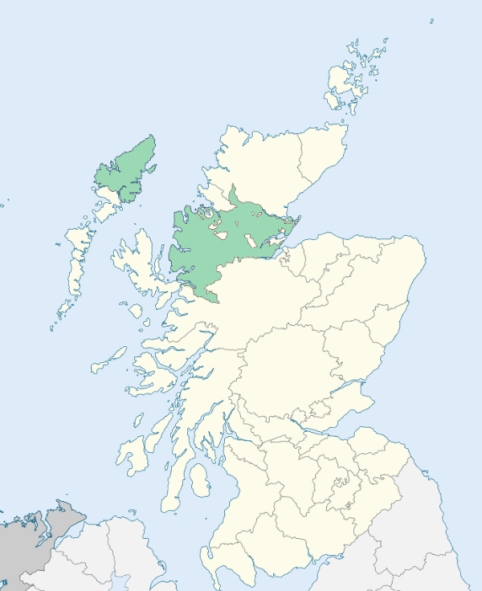
Stornoway is a parish in the Lewis district of the Outer Hebrides. It is bounded by the Minch, and by the parishes of Lochs, Uig, and Barvas. (1867: The Imperial Gazetteer of Scotland, by John Marius Wilson).
Back, Bayble, Bayhead, Coll, Garabost, Knock, Laxdale, Lower Bayble, Sandwick, Swordle, Stornoway, Tolsta, Tong, Upper Bayble, Vatsker
PRE-REFORMATION GOVERNANCE:
POST-REFORMATION GOVERNANCE:
In the sixteenth century the parishes of Stornoway, Gress, Ey, Lochs, and Uig were all united in one charge. On 19 December 1722 the Lords Commissioners of Teinds disjoined the parish of Lochs from Stornoway, Gress, and Ey.
Stornoway. The church of Stornoway was dedicated to St Adamnan.
Gress. The church of Gress, now ruinous, was dedicated to St Olaf. At Tolsta in this parish stood a chapel of St Michael.
Disjoined Quoad Sacra Parishes:
Knock, previously Kilcholuimcill. The church of Ey, now roofless, was dedicated to St Columba. About the year 1828 a parliamentary church for the district of Ey was built at Knock. On 27 May 1857 this ancient parish was disjoined quoad sacra from Stornoway, Lochs, and Gress. The name of Knock was given it from the site of its modern church. At Garrabost, within the bounds, there was a chapel of St Constantine, and beside it lay St Constantine's Well.
Includes ministers, licentiates, assistants, readers, and clerks.
Stornoway (QO)
Knock, or Kilcholuimcill (QS)
(1928: Fasti Ecclesiæ Scoticanæ, by Hew Scott, D. D.)
Parish registers turned over to the Registrar-General, as a result of the Registration of Births, Deaths, and Marriages (Scotland) Act of 1854. The letters B. D. and M. indicate Births (or Baptisms), Deaths (or Burials), and Marriages (or Proclamations of Banns) respectively. Numbers indicate separate volumes or books. Note: These records are by no means complete or without damage; consult the Detailed List of the Old Parochial Registers of Scotland (1872) to learn more about the condition of the records.
| OPR and RD Numbers | |||
|---|---|---|---|
| Date Range | Name | Number | Type |
| 1762-1854 | Stornoway | 88 | OPR |
| 1855-1967 | Stornoway | 88 | RD |
| 1968-1971 | Stornoway and North Lochs | 88 | RD |
| 1972-2002 | Stornoway | 221 | RD |
| 2009 | Comhairle Nan Eilean Siar, Stornoway | 221 | RD |
| 2026 | Comhairle Nan Eilean Siar, Stornoway Community Council | ||
(2009: Parishes and Registration Districts of Scotland - Old and New, National Records of Scotland)
Local community councils (2026) are provided as a potential source of additional information for settlements within the original boundaries of the parish. (Source)
Statistics from informal and official censuses
Campbell, Graham, MacAulay, MacDonald, MacIver, Mackenzie, MacLeod, Morrison, Murray, Smith
Note: Names appearing in research materials, other than censuses. Simple names (First name, surname only) have been omitted unless they appear associated with large properties. All women's names, and men's names with occupations, military ranks, or peerage titles are included.
By the Reverend Mr Colin Mackenzie.
"There are in this parish 556 families; 287 in the country, 139 in the town. The residing tradesmen are 11 joiners, 4 masons, 7 carpenters, 2 smiths in the town, 2 smiths in the country, 11 tailors, 16 shoemakers, 13 weavers, 2 wheel-wrights, 4 gardeners, 8 shopkeepers and 5 innkeepers. The total population in 1796 is 2639. The common people of this island marry very early, and when death separates them, if the surviving party, whether male or female, finds it convenient to engage a second or third time in that state, some of them remain a few weeks, and some only a few days, in widowhood; so that that grief for the loss of husband or wife is an affliction little known among the lower class of people here."
(This section contains excerpts, at times restructured or paraphrased, from an article appearing in Statistical Account of Scotland, Sir John Sinclair, 1791-1799)
Primary Sources:
Statistical Account of Scotland (1791-1799), Volume 19, p. 241
New Statistical Account of Scotland (1834-1845), Volume 14, Section II, p. 115
See Parish Page Sources for all source information and links.