Balmakiel
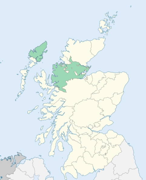
Uig is a Hebridean parish in the south-west of Lewis, Ross-shire. The parish comprehends the Flannan Isles, the islands of Bernera and Pabba, and ten other small islands, but consists mainly of the district of Uig proper and the district of Carloway or Callanaish on the mainland of Lewis. The district of Uig proper is bounded on the north by the ocean and Carloway, on the east by Stornoway, on the south-east by Lochs, on the south by Harris and Loch Resort, and on the west by the ocean. (1867: The Imperial Gazetteer of Scotland, by John Marius Wilson).
Braenish, Breasclet, Callernish, Carloway, Garrynahine, Kirvig, Valtos or Voltos
The parish of Lochs had a detached part situated at Carloway, and lying between the parishes of Barvas and Uig. This detached part has been divided between the parishes of Barvas and Uig. See affected properties and landholders. (1892: Boundary of counties and parishes in Scotland as settled by the Boundary Commissioners under the Local Government Act, 1889, by Hay Shennan)
PRE-REFORMATION GOVERNANCE:
POST-REFORMATION GOVERNANCE:
The church of Uig was dedicated to St Christopher. In the sixteenth century the parishes of Stornoway, Gress, Ey, Lochs, and Uig were all joined in one charge. On 19 December 1722, the Lords Commissioners of Teinds severed Uig again from the other four. On Gallan Head, within the bounds, there stands, somewhat ruined, a chapel of very ancient form, built of dry undressed stone. It bears the name of Tigh Bheannachaidh ("The House of Blessing"). At Kirvig there was a chapel of St Michael, and on the island of Great Bernera stood chapels of St Donan and St Michael. There are now four mission chapels in the parish of Uig. One stands on Great Bernera and the others are at Voltos, the Aird, and Braenish.
Includes ministers, licentiates, assistants, readers, and clerks.
(1928: Fasti Ecclesiæ Scoticanæ, by Hew Scott, D. D.)
Parish registers turned over to the Registrar-General, as a result of the Registration of Births, Deaths, and Marriages (Scotland) Act of 1854. The letters B. D. and M. indicate Births (or Baptisms), Deaths (or Burials), and Marriages (or Proclamations of Banns) respectively. Numbers indicate separate volumes or books. Note: These records are by no means complete or without damage; consult the Detailed List of the Old Parochial Registers of Scotland (1872) to learn more about the condition of the records.
| OPR and RD Numbers | |||
|---|---|---|---|
| Date Range | Name | Number | Type |
| 1824-1854 | Uig | 89 | OPR |
| 1855-1971 | Uig | 89 | RD |
| 1972-2006 | Uig | 223 | RD |
| 2009 | Comhairle Nan Eilean Siar, Uig | 223 | RD |
| 2026 | Comhairle Nan Eilean Siar, Uig Community Council | ||
(2009: Parishes and Registration Districts of Scotland - Old and New, National Records of Scotland)
Local community councils (2026) are provided as a potential source of additional information for settlements within the original boundaries of the parish. (Source)
Statistics from informal and official censuses
MacAulay, MacDonald, MacIver, MacKay, Mackenzie, MacLean, MacLeod, Matheson, Morrison, Smith
Note: Names appearing in research materials, other than censuses. Simple names (First name, surname only) have been omitted unless they appear associated with large properties. All women's names, and men's names with occupations, military ranks, or peerage titles are included.
By the Reverend Mr Hugh Munro.
"There are in the parish 275 net-makers, 299 kelp-makers, 26 weavers, 9 wrights, 7 tailors, and 3 blacksmiths. There are at present more instances of longevity here (as is always the case) than in any other parish in the island; several near 90, and some above that age, are at present alive. They marry very young, and barrenness is scarcely known.
All the people dwell in little farm villages, and they fish in the summer season. The women do not fish; but almost at all times, when there is occasion to go to sea, they never decline that service, and row powerfully. When they go to the hills with their cattle, all descriptions of sex and age angle on the freshwater lakes.
All the woollen and linen cloth used for common purposes is spun and wove in the parish. In the parish are four or five boat-carpenters and several persons who make broags (shoes) of leather tanned by the inhabitants with tormentil root. There are no instances known of suicide. Many of the people in the parish are employed in manufacturing kelp, and many of them go for the same purpose to Harris and Uist."
(This section contains excerpts, at times restructured or paraphrased, from an article appearing in Statistical Account of Scotland, Sir John Sinclair, 1791-1799)
Primary Sources:
Statistical Account of Scotland (1791-1799), Volume 19, p. 280
New Statistical Account of Scotland (1834-1845), Volume 14, Section II, p. 151
See Parish Page Sources for all source information and links.