Inchcailloch, Inchcailleach
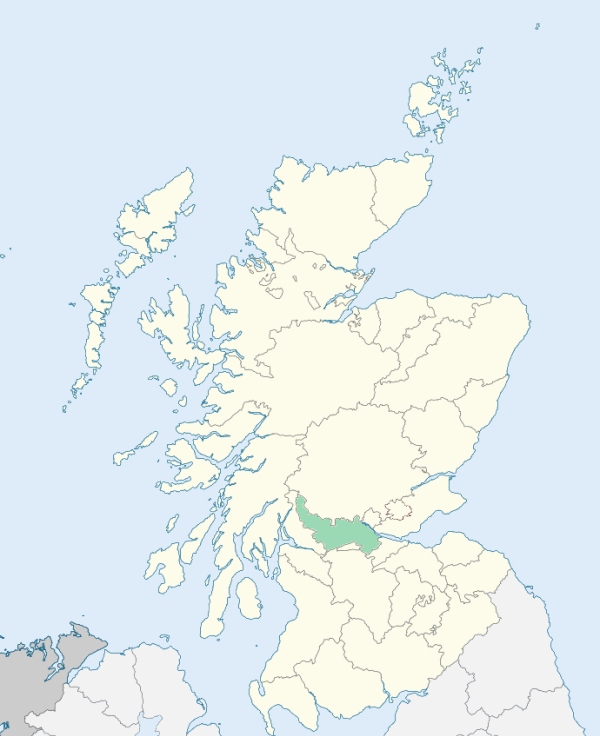
Buchanan is a parish in the western extremity of Stirlingshire. It is bounded on the north by Perthshire and Loch Katrine, on the east by Perthshire and the parish of Drymen, on the south by Dumbartonshire, from which it is separated by the Endrick River, and along the whole of its western side by Loch Lomond. (1867: The Imperial Gazetteer of Scotland, by John Marius Wilson).
Balmaha, Buchanan, Buchanan Smith, Inversnaid, Milton, Rowardennan, Stronachlachar
Clairinch, Inchcailloch, Infad, Inchcruin Buchanan
PRE-REFORMATION GOVERNANCE:
POST-REFORMATION GOVERNANCE:
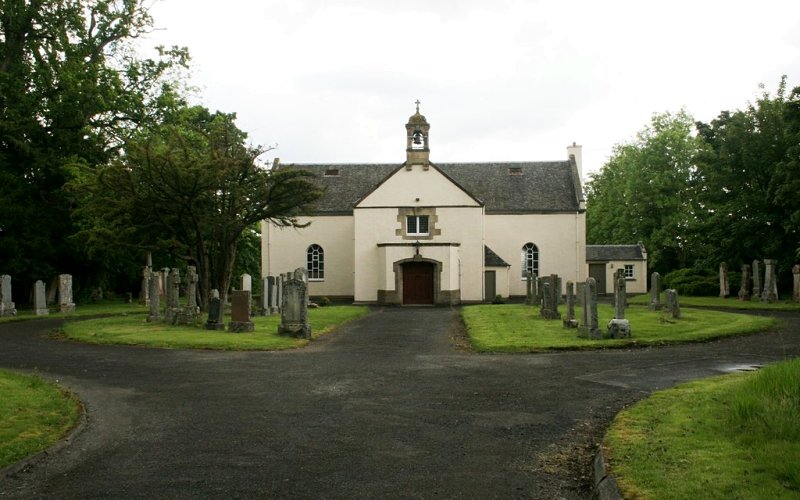
The church of Inniscailloch (Innis Cailleach = the Isle of Nuns) was dedicated to St Kentigerna, the mother of St Fillan of Glendochart. Its site is on an island in Loch Lomond. In 1621 the lands of Buchanan were taken from the parish of Luss and annexed to Inniscailloch. In 1643 the parish church was removed from the island to a more accessible situation at Buchanan. In early times there had been at Inniscailloch a nunnery of St Kentigerna. At the place where the Water of Endrick flows into Loch Lomond there was a chapel of St Mary. At Invernaid, in the parish, there is now a mission chapel of St Kentigerna.
Includes ministers, licentiates, assistants, readers, and clerks.
(1928: Fasti Ecclesiæ Scoticanæ, by Hew Scott, D. D.)
Parish registers turned over to the Registrar-General, as a result of the Registration of Births, Deaths, and Marriages (Scotland) Act of 1854. The letters B. D. and M. indicate Births (or Baptisms), Deaths (or Burials), and Marriages (or Proclamations of Banns) respectively. Numbers indicate separate volumes or books. Note: These records are by no means complete or without damage; consult the Detailed List of the Old Parochial Registers of Scotland (1872) to learn more about the condition of the records.
| OPR and RD Numbers | |||
|---|---|---|---|
| Date Range | Name | Number | Type |
| 1646-1854 | Buchanan | 474 | OPR |
| 1855-1910 | Buchanan | 474 | RD |
| 1911-1970 | Buchanan | 474-1 | RD |
| 1911-1970 | Inversnaid | 474-2 | RD |
| 1971-1971 | Buchanan and Invernsaid | 474 | RD |
| 1972-1976 | Buchanan | 474 | RD |
| 1972-1989 | Inversnaid | 474 | RD |
| 2009 | (Buchanan) Stirling, Balfron | 472 | RD |
| 2009 | (Inversnaid) Stirling, Aberfoyle | 397 | RD |
| 2026 | (Buchanan) Stirling Council; Buchanan Community Council | ||
| 2026 | (Inversnaid) Stirling Council; Strathard Community Council | ||
(2009: Parishes and Registration Districts of Scotland - Old and New, National Records of Scotland)
Local community councils (2026) are provided as a potential source of additional information for settlements within the original boundaries of the parish. (Source)
Statistics from informal and official censuses
Archibald, Blair, Buchanan, Campbell, Clark, MacDougall, MacFarlane, Scott, Stewart, Turner
Note: Names appearing in research materials, other than censuses. Simple names (First name, surname only) have been omitted unless they appear associated with large properties. All women's names, and men's names with occupations, military ranks, or peerage titles are included.
By the Reverend Mr David MacGibbon.
"According to the last list which I took, of the inhabitants, they were 1111 souls. Some years ago there were several Roman Catholics, and a few of the Episcopal Communion; but there are none of these denominations now, so far as I know, at least as common residenters.
There are no manufactures in this parish. There are in it 6 weavers, 3 shoemakers, 2 tailors, 1 smith, 2 boat carpenters, 2 millers, no wrights nor masons, except such as work constantly to the Duke of Montrose. All the servants in this parish are domestic or household, except such as work to the Duke, who have each of them who go under the denomination of his workmen, a house and garden, a cow's grazing-park, for their accommodation, with 4 acres of ground.
The people are generally sober. There are no villages in the parish, nor even what deserves the name of a clachan at the church. There are only 3 licensed public houses. The people are hospitable, and very charitably disposed towards the poor. They live in peace and harmony among themselves, and are very ready to oblige and assist one another when needs requires."
(This section contains excerpts, at times restructured or paraphrased, from an article appearing in Statistical Account of Scotland, Sir John Sinclair, 1791-1799)
Primary Sources:
Statistical Account of Scotland (1791-1799), Volume 9, p. 12
New Statistical Account of Scotland (1834-1845), Volume 8, Section II, p. 89
See Parish Page Sources for all source information and links.