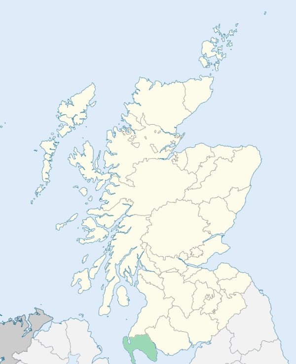
Inch is a parish in the north-west of Wigtownshire. It is bounded on most of the west by Loch Ryan, on the north by Ayrshire, and on other sides by the parishes of New Luce, Old Luce, Stoneykirk, Portpatrick, Leswalt, and Stranraer. (1867: The Imperial Gazetteer of Scotland, by John Marius Wilson).
Aird, Cairnryan, Castle Kennedy, Innermessan, Laight, Lochans, Marchburn, Mark
PRE-REFORMATION GOVERNANCE:
POST-REFORMATION GOVERNANCE:
Inch. The church of this parish stands on the shore of Loch Inch, near the island from which both loch and church are named. Until the Reformation this church belonged to the Bishop of Galloway. In the parish of Inch were two chapels: St John's, beside which the town of Stranraer grew up; and St Patrick's, which gave rise to Portpatrick. Balnab (Baile an Aig = the Abbot's place), in the parish of Inch, was a possession of the abbots of Glen Luce.
Saulseat. The church of Saulseat belonged to the Abbey of Saulseat, within the parish. This monastery was the earliest Premonstratensian foundation in Scotland. It was built in 1148 by Fergus, Lord of Galloway, and was dedicated to St John the Evangelist.
Disjoined Quoad Sacra Parishes:
Lochryan. A church was built at Cairnryan in 1841. The parish of Lochryan was disjoined from Inch, 3 March 1858.
Sheuchan. A church was built here in 1841. The parish was disjoined from Inch and erected quoad sacra, 30 June 1868.
Includes ministers, licentiates, assistants, readers, and clerks.
Inch (QO)
Lochryan (QS)
Sheuchan (QS)
(1928: Fasti Ecclesiæ Scoticanæ, by Hew Scott, D. D.)
Parish registers turned over to the Registrar-General, as a result of the Registration of Births, Deaths, and Marriages (Scotland) Act of 1854. The letters B. D. and M. indicate Births (or Baptisms), Deaths (or Burials), and Marriages (or Proclamations of Banns) respectively. Numbers indicate separate volumes or books. Note: These records are by no means complete or without damage; consult the Detailed List of the Old Parochial Registers of Scotland (1872) to learn more about the condition of the records.
| OPR and RD Numbers | |||
|---|---|---|---|
| Date Range | Name | Number | Type |
| 1728-1854 | Inch | 886 | OPR |
| 1855-1966 | Inch | 886 | RD |
| 2009 | Dumfries and Galloway, Stranraer | 870 | RD |
| 2026 | Dumfries and Galloway Council; Cairnryan Community Council | ||
(2009: Parishes and Registration Districts of Scotland - Old and New, National Records of Scotland)
Local community councils (2026) are provided as a potential source of additional information for settlements within the original boundaries of the parish. (Source)
Statistics from informal and official censuses
Brown, Davidson, Gibson, Graham, Hamilton, Johnstone, Murray, Rankin, Watson, Wilson
Note: Names appearing in research materials, other than censuses. Simple names (First name, surname only) have been omitted unless they appear associated with large properties. All women's names, and men's names with occupations, military ranks, or peerage titles are included.
By the Reverend Mr Peter Ferguson.
"The whole inhabitants of this parish amount to 1450 souls, of which number 701 are males, and 749 females. The number of Seceders, young and old, may be stated at 240.
The Cairn is the only considerable village in the parish, and contains 130 souls. Here many vessels from the West Indies, bound for Clyde, take refuge from the storm, and ride in perfect safety. The Cairn is well situated for foreign trade, and excellently adapted for ship-building.
The inhabitants are in general sober, intelligent, social, and hospitable. Their knowledge of agriculture, for these last twenty years, is much enlarged, and their habits of life much improved."
(This section contains excerpts, at times restructured or paraphrased, from an article appearing in Statistical Account of Scotland, Sir John Sinclair, 1791-1799)
Primary Sources:
Statistical Account of Scotland (1791-1799), Volume 3, p. 134
New Statistical Account of Scotland (1834-1845), Volume 4, Section III, p. 80
See Parish Page Sources for all source information and links.