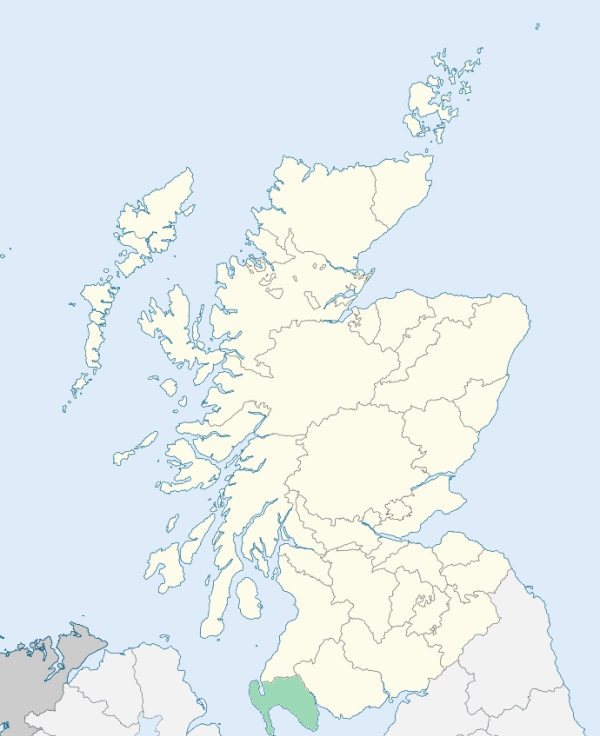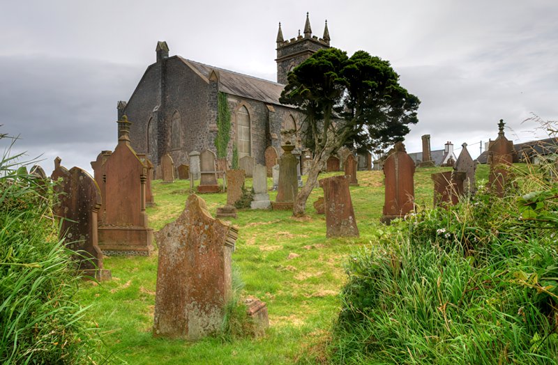
Stoneykirk is a parish in the Rhinns district of Wigtownshire. It is bounded on the north by Portpatrick and Inch, on the north-east by Old Luce, on the east by Luce Bay, on the south by Kirkmaiden, and on the west by the Irish channel. (1867: The Imperial Gazetteer of Scotland, by John Marius Wilson).
Clachshant, Kirkmadrine, Sandhead, Stoneykirk, Toskerton
Ardwell, Balgreggan
PRE-REFORMATION GOVERNANCE:
POST-REFORMATION GOVERNANCE:
The parishes of Stoneykirk, Clayshant, and Toskertoun were united in 1618.
Stoneykirk. The church of this parish was dedicated to St Stephen, from whom it took its name. In the parish were the two hospitals of Meikle and Little Spital, which have given rise to the modern names of Port Spital and Spital Mill. There were also within the bounds three chapels: St Brioch's at Kirkmabreck, St Donan's at Kildonan, and St Lashrean's at Killaser.
Clayshant. The old name of this parish was Clachshant (Clach Séant = The Holy Stone). The church belonged to the Priory of Whitern (Whithorn).
Toskertoun. The church of Toskertoun, now generally called Kirkmadryne, belonged to the Priory of Whitern (Whithorn). The church was dedicated to St Medran of Muskerry.
Disjoined Quoad Sacra Parishes:
Ardwell. This parish was disjoined from Stoneykirk, 7 March 1902. With the exception of grants from Church funds, the church (dedicated 27 Feb 1902) was built, and parish endowed by Mrs Ommaney M'Taggart of Ardwell, and Sir Mark and Lady M'Taggart Stewart.
Includes ministers, licentiates, assistants, readers, and clerks.
Stoneykirk (QO)
Ardwell (QS)
(1928: Fasti Ecclesiæ Scoticanæ, by Hew Scott, D. D.)
Parish registers turned over to the Registrar-General, as a result of the Registration of Births, Deaths, and Marriages (Scotland) Act of 1854. The letters B. D. and M. indicate Births (or Baptisms), Deaths (or Burials), and Marriages (or Proclamations of Banns) respectively. Numbers indicate separate volumes or books. Note: These records are by no means complete or without damage; consult the Detailed List of the Old Parochial Registers of Scotland (1872) to learn more about the condition of the records.
| OPR and RD Numbers | |||
|---|---|---|---|
| Date Range | Name | Number | Type |
| 1744-1854 | Stoneykirk | 898 | OPR |
| 1855-1966 | Stoneykirk | 898 | RD |
| 2009 | Dumfries and Galloway, Stranraer | 870 | RD |
| 2026 | Dumfries and Galloway Council; Stoneykirk Community Council | ||
(2009: Parishes and Registration Districts of Scotland - Old and New, National Records of Scotland)
Local community councils (2026) are provided as a potential source of additional information for settlements within the original boundaries of the parish. (Source)
Statistics from informal and official censuses
Campbell, Gibson, Hannah, Kilpatrick, Muir, Murray, Nelson, Paterson, Preston, Wilson
Note: Names appearing in research materials, other than censuses. Simple names (First name, surname only) have been omitted unless they appear associated with large properties. All women's names, and men's names with occupations, military ranks, or peerage titles are included.
By the Reverend Mr Henry Bain.
"There are 1365 individuals in the parish. The population is as follows: On the lands of Ardwell there are 460 individuals, of whom 82 are under 10 years of age. There are 36 farmers, 156 in farmers' families, 24 mechanics, 8 apprentices, 40 household servants, 104 inhabited houses.
In the remainder of the parish there are: 852 individuals, of whom 384 are males, 468 are females; 176 are under 10 years of age. The inhabitants, upon the whole, enjoy good health, and live to an advanced age.
Some years ago, salt was manufactured at two places in this parish; but the practice is now discontinued, probably, because it was found easier to smuggle that article from Ireland. There is some kelp made here every year, and generally exported to Ireland. The coarse yarn spun by the old women, is usually brought to the fairs, and there readily bought up to made into Osnaburgs for the West Indian market. There is in this parish a bleach-field, and four mills for dressing flax, also a mill for making pot or pearl barley, with a view of preparing that article for the Liverpool market."
(This section contains excerpts, at times restructured or paraphrased, from an article appearing in Statistical Account of Scotland, Sir John Sinclair, 1791-1799)
Primary Sources:
Statistical Account of Scotland (1791-1799), Volume 2, p. 51
New Statistical Account of Scotland (1834-1845), Volume 4, Section III, p. 162
See Parish Page Sources for all source information and links.