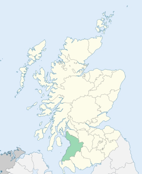
Stevenston is a parish on the coast of Cunningham, Ayrshire. It is bounded by the Firth of Clyde, and by the parishes of Ardrossan, Kilwinning, Irvine, and Dundonald. (1867: The Imperial Gazetteer of Scotland, by John Marius Wilson).
Pipers Heugh, Saltcoats, Stevenston
Hayocks, Hullerhurst, Kerelaw, Mayville
PRE-REFORMATION GOVERNANCE:
POST-REFORMATION GOVERNANCE:
The vicarage of Stevenston belonged to the Abbey of Kilwinning. The church was dedicated to St Monach. A fair was held annually at Stevenston on St Monach's Day, 30th October. The parish church was rebuilt in 1833. There is a mission chapel within the bounds at Ardeer.
Includes ministers, licentiates, assistants, readers, and clerks.
(1928: Fasti Ecclesiæ Scoticanæ, by Hew Scott, D. D.)
Parish registers turned over to the Registrar-General, as a result of the Registration of Births, Deaths, and Marriages (Scotland) Act of 1854. The letters B. D. and M. indicate Births (or Baptisms), Deaths (or Burials), and Marriages (or Proclamations of Banns) respectively. Numbers indicate separate volumes or books. Note: These records are by no means complete or without damage; consult the Detailed List of the Old Parochial Registers of Scotland (1872) to learn more about the condition of the records.
| OPR and RD Numbers | |||
|---|---|---|---|
| Date Range | Name | Number | Type |
| 1700-1854 | Stevenston | 615 | OPR |
| 1855-1968 | Stevenston | 615 | RD |
| 2009 | North Ayrshire, Saltcoat | 662 | RD |
| 2026 | North Ayrshire Council; Stevenston Community Council | ||
(2009: Parishes and Registration Districts of Scotland - Old and New, National Records of Scotland)
Local community councils (2026) are provided as a potential source of additional information for settlements within the original boundaries of the parish. (Source)
Statistics from informal and official censuses
Boyd, Brown, Frew, Hamilton, Kerr, Reid, Scott, Smith, Thomson, Wilson
Note: Names appearing in research materials, other than censuses. Simple names (First name, surname only) have been omitted unless they appear associated with large properties. All women's names, and men's names with occupations, military ranks, or peerage titles are included.
By the Reverend Dr James Wodrow.
"The number of souls from an actual survey in April 1791 was 2425. There were in Saltcoats 1131 souls; in the country, 275. About ten years ago, a Relief meeting-house was built near Saltcoats, There are about 80 families in this parish of that persuasion, 14 families of Burghers and Antiburghers, and a single Cameronian. Three persons in the parish were born in England, five or six in Ireland, and more than a half of the heads of families born in other districts of Scotland.
There are 20 families of farmers, six or eight cottagers, or persons in that style, though they may hold their small possessions from a proprietor. The number of those individuals in the parish who are and have been sailors cannot be ascertained, probably between two and three hundred. There are above 200 employed about the coal, about 70 weavers, 19 wrights, 17 masons, 8 smiths, 10 shoemakers, 10 tailors, 16 carters and carriers, 5 butchers, 3 bakers, above 50 household servants, chiefly female, and about 24 labouring men servants.
The principal object worthy of attention in this parish is the town of Saltcoats, and the coal-mines in its neighbourhood. There are now about 400 houses in Saltcoats. There are upwards of 200 men, exclusive of boys, employed at two colleries. There is a rope-yard which constantly employs, at an average, 25 men; three or four of whom are employed in making (sewing) sails. In the south, or Stevenston side, of the town of Saltcoats, there are 169 houses in Saltcoats, inhabited by 1131 persons.
The writer of this, during a residence of more than 30 years, has had the satisfaction of observing a gradual, yet a very striking change on the face of the parish, by canals, and other efforts, which have increased the mining, trade, and shipping; by good roads, convenient bridges, well built houses, both in the towns and country. These things have improved the situation of the inhabitants, with respect to most of the conveniences and comforts of life."
(This section contains excerpts, at times restructured or paraphrased, from an article appearing in Statistical Account of Scotland, Sir John Sinclair, 1791-1799)
Primary Sources:
Statistical Account of Scotland (1791-1799), Volume 7, p. 1
New Statistical Account of Scotland (1834-1845), Volume 5, Section I, p. 426
See Parish Page Sources for all source information and links.