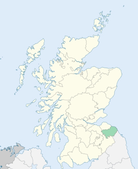
Legerwood is a parish on the west border of Berwickshire. It is bounded by Roxburghshire, and by the parishes of Lauder, Westruther, Gordon, and Earlston. (1867: The Imperial Gazetteer of Scotland, by John Marius Wilson).
Birkhillside, Boonmill, Bridgend, Cambridge, Corsbie, Dods, Kirkhill, Legerwood, West Moriston
Birkhillside
PRE-REFORMATION GOVERNANCE:
POST-REFORMATION GOVERNANCE:
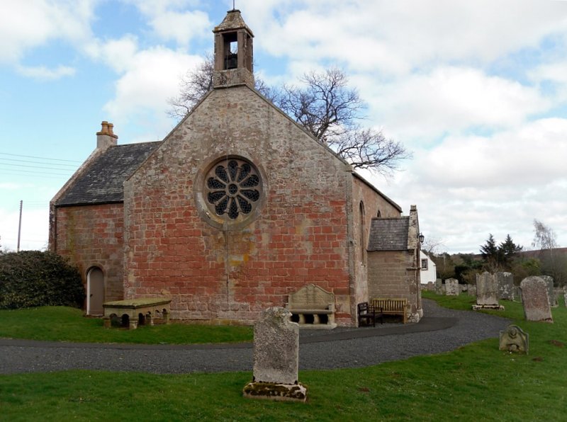
A church existed here in the early part of the twelfth century. About the same period the church passed into the possession of the Abbey of Paisley, and was held by it till the Reformation. The church was restored in 1898. There was a hospital of St Mary Magdalen at Morriston.
Includes ministers, licentiates, assistants, readers, and clerks.
Parish (QO)
(1928: Fasti Ecclesiæ Scoticanæ, by Hew Scott, D. D.)
Parish registers turned over to the Registrar-General, as a result of the Registration of Births, Deaths, and Marriages (Scotland) Act of 1854. The letters B. D. and M. indicate Births (or Baptisms), Deaths (or Burials), and Marriages (or Proclamations of Banns) respectively. Numbers indicate separate volumes or books. Note: These records are by no means complete or without damage; consult the Detailed List of the Old Parochial Registers of Scotland (1872) to learn more about the condition of the records.
| OPR and RD Numbers | |||
|---|---|---|---|
| Date Range | Name | Number | Type |
| 1689-1854 | Legerwood | 749 | OPR |
| 1855-1966 | Legerwood | 749 | RD |
| 2009 | Scottish Borders | 792 | RD |
| 2026 | Scottish Borders Council; Lauderdale Community Council | ||
(2009: Parishes and Registration Districts of Scotland - Old and New, National Records of Scotland)
Local community councils (2026) are provided as a potential source of additional information for settlements within the original boundaries of the parish. (Source)
Statistics from informal and official censuses
Aitchison, Bell, Brown, Fairley, Haig, Lees, Renwick, Robertson, Scott, Yule
Note: Names appearing in research materials, other than censuses. Simple names (First name, surname only) have been omitted unless they appear associated with large properties. All women's names, and men's names with occupations, military ranks, or peerage titles are included.
From Materials communicated by Messrs Murray and Mirtle of this Parish.
"In the year 1755, the population of Legerwood was stated to Dr Webster to amount to 398. It is inhabited at present by 422 persons in all, of both sexes, and of every age and condition. Except about 40 Dissenters, they are all content with the religious instruction to be received in their parish church.
The whole lands of the parish are divided into 17 farms, large or small, which are occupied by as many different farmers. These farmers, and the hinds, labourers, and shepherds in their service, with their respective families, compose almost the whole population. There are two or three tailors, and one weaver. Three smiths and two joiners perform that work in wood and iron, which is requisite to repair, from time to time, the implements of farm-labour, &c. As to the requisite imports of coal, lime, grocer's goods, draper's goods, hardware, stationer's goods, &c., these are all obtained from Kelso, Lauder, Dalkeith, and Edinburgh.
The present dwelling-houses are dispersed over the farms; only, on the farm of Legerwood (proper), is there such an assemblage of houses together, as composes a hamlet, or incipient village.
The inhabitants of this parish appear to be in general healthy, sober, virtuous, industrious, and intelligent. Most of the articles of dress used here are imported, not manufactured within the parish. The language of this parish having, for these last 1200 years, been chiefly Saxon, is at present, with that spoken through all Berwickshire and in Northumberland, more substantially Saxon than the language of any other district in Great Britain."
(This section contains excerpts, at times restructured or paraphrased, from an article appearing in Statistical Account of Scotland, Sir John Sinclair, 1791-1799)
Primary Sources:
Statistical Account of Scotland (1791-1799), Volume 16, p. 484
New Statistical Account of Scotland (1834-1845), Volume 2, Section III, p. 347
See Parish Page Sources for all source information and links.