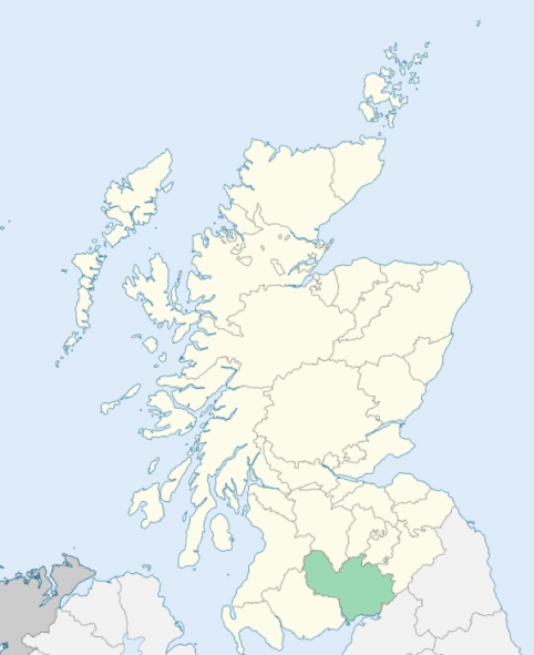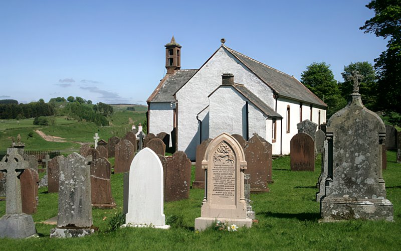
Hutton and Corrie is a united parish in Annandale, Dumfriesshire. It is bounded by Moffat, Eskdalemuir, Westerkirk, Tundergarth, Dryfesdale, Applegarth, and Wamphray. Hutton consists of the northern division of the present parish, or the part of it which is watered by the Dryfe. Corrie, or the southern division of the united parish, was, as to its lands an ecclesiastical patronage held in the 12th century by a vassal family of Robert de Bruce. (1867: The Imperial Gazetteer of Scotland, by John Marius Wilson).
Boreland, Corrie, Corrie Common, Gillesbie, Hutton
Hutton Hall, Whiteknow
PRE-REFORMATION GOVERNANCE:
POST-REFORMATION GOVERNANCE:
The parishes of Hutton and Corrie were united in 1609. Until 1193 Hutton was a chapel of Sibbaldie. There are still remains of the old church of Corrie.
Includes ministers, licentiates, assistants, readers, and clerks.
(1928: Fasti Ecclesiæ Scoticanæ, by Hew Scott, D. D.)
Parish registers turned over to the Registrar-General, as a result of the Registration of Births, Deaths, and Marriages (Scotland) Act of 1854. The letters B. D. and M. indicate Births (or Baptisms), Deaths (or Burials), and Marriages (or Proclamations of Banns) respectively. Numbers indicate separate volumes or books. Note: These records are by no means complete or without damage; consult the Detailed List of the Old Parochial Registers of Scotland (1872) to learn more about the condition of the records.
| OPR and RD Numbers | |||
|---|---|---|---|
| Date Range | Name | Number | Type |
| 1745-1854 | Hutton and Corrie | 831 | OPR |
| 1855-1968 | Hutton and Corrie | 831 | RD |
| 2009 | Dumfries and Galloway, Lockerbie | 837 | RD |
| 2026 | Dumfries & Galloway Council; North Milk Community Council | ||
(2009: Parishes and Registration Districts of Scotland - Old and New, National Records of Scotland)
Local community councils (2026) are provided as a potential source of additional information for settlements within the original boundaries of the parish. (Source)
Statistics from informal and official censuses
Anderson, Beattie, Bell, Graham, Halliday, Irving, Johnstone, Little, Moffat, Scott
Note: Names appearing in research materials, other than censuses. Simple names (First name, surname only) have been omitted unless they appear associated with large properties. All women's names, and men's names with occupations, military ranks, or peerage titles are included.
By William Stewart, Esq., of Hillside.
"The number of inhabitants of these parishes in 1755 was 993. In 1793, they are of all ages, 583. The decrease has probably been owing to laying farms together. The restriction of each farm to one tenant has been found the first necessary step to improvement, particularly for improvement of sheep and cattle. The number of farmers, as observed, is 41, and cottagers of all kinds 85, which includes 2 millers, 1 dyer and waulk-miller, 1 shopkeeper, 1 publican, 2 tailors, 1 shoemaker, 15 weavers, 2 wrights, the rest labourers and herds.
The people of these parishes have been at all times regular in their conduct, and well disposed to government. They are generally sober and industrious in their way, and their manners becoming and respectful. In justice to the female part of them it must be said, that in industry and sobriety they excel, with scarce an exception remembered. Where a farmer has not thrived, the blame has ever been on his side of the house."
(This section contains excerpts, at times restructured or paraphrased, from an article appearing in Statistical Account of Scotland, Sir John Sinclair, 1791-1799)
Primary Sources:
Statistical Account of Scotland (1791-1799), Volume 13, p. 567
New Statistical Account of Scotland (1834-1845), Volume 4, Section I, p. 537
See Parish Page Sources for all source information and links.