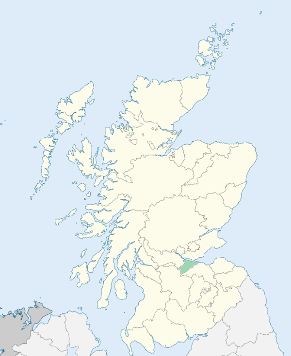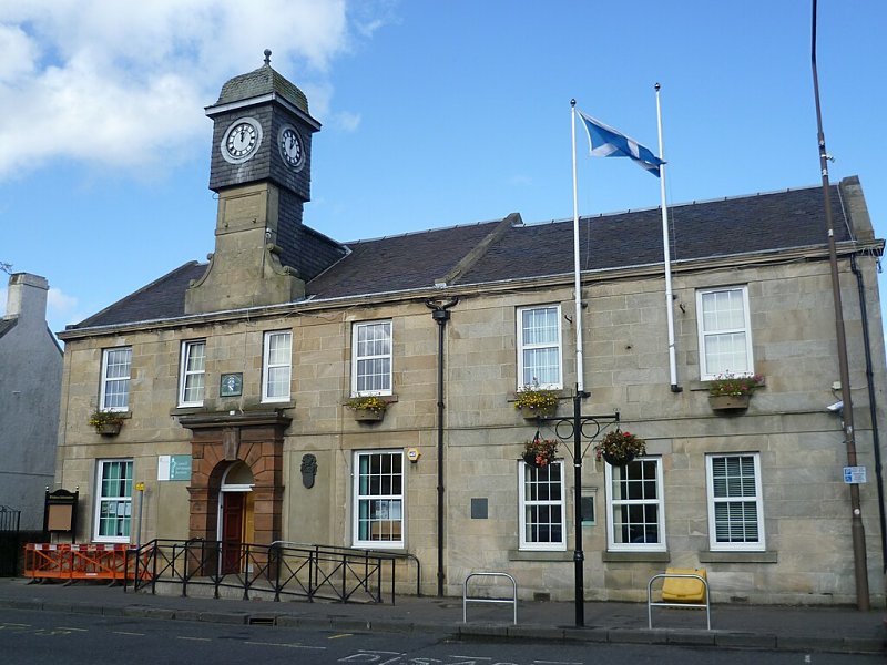
Whitburn is a parish occupying the south-west corner of Linlithgowshire. It is bounded on the north by Lanarkshire and Bathgate, on the east by Livingston, on the south by the south-west projection of Edinburghshire, and on the west by Lanarkshire. (1867: The Imperial Gazetteer of Scotland, by John Marius Wilson).
Benhar, Bents, Blackburn, Crofthead, Drybridge, Fauldhouse, Gateside, Greenburn, Longridge or Lanrig, Linlithgow Bridge, Whitburn
Polkemmet
PRE-REFORMATION GOVERNANCE:
POST-REFORMATION GOVERNANCE:
The church was opened 21 October 1718. Parish disjoined from Livingston, and erected by the Commissioners of Teinds, 23 June 1731.
Disjoined Quoad Sacra Parishes:
Fauldhouse. Disjoined from Whitburn and erected a parish quoad sacra by Court of Teinds, 8 July 1872. Church built in 1867.
Includes ministers, licentiates, assistants, readers, and clerks.
Whitburn (QO)
Fauldhouse (QS)
(1928: Fasti Ecclesiæ Scoticanæ, by Hew Scott, D. D.)
Parish registers turned over to the Registrar-General, as a result of the Registration of Births, Deaths, and Marriages (Scotland) Act of 1854. The letters B. D. and M. indicate Births (or Baptisms), Deaths (or Burials), and Marriages (or Proclamations of Banns) respectively. Numbers indicate separate volumes or books. Note: These records are by no means complete or without damage; consult the Detailed List of the Old Parochial Registers of Scotland (1872) to learn more about the condition of the records.
| OPR and RD Numbers | |||
|---|---|---|---|
| Date Range | Name | Number | Type |
| 1719-1854 | Whitburn | 673 | OPR |
| 1855-1874 | Whitburn | 673 | RD |
| 1875-1971 | Whitburn | 673-1 | RD |
| 1875-1971 | Fauldhouse | 673-2 | RD |
| 1875-1971 | Stoneyburn | 673-3 | RD |
| 1972-1974 | Stoneyburn | 712 | RD |
| 1972-1974 | Fauldhouse | 713 | RD |
| 1972-2002 | Whitburn | 711 | RD |
| 2003-2008 | Whitburn, West Lothian | 776 | RD |
| 2009 | West Lothian, Whitburn | 776 | RD |
| 2026 | (Whitburn) West Lothian Council; Whitburn Community Council | ||
| 2026 | (Fauldhouse) West Lothian Council; Fauldhouse Community Council | ||
| 2026 | (Stoneyburn) West Lothian Council; Stoneyburn Community Council | ||
(2009: Parishes and Registration Districts of Scotland - Old and New, National Records of Scotland)
Local community councils (2026) are provided as a potential source of additional information for settlements within the original boundaries of the parish. (Source)
Statistics from informal and official censuses
Black, Brown, Graham, Meek, Reid, Russell, Smith, Thomson, Weir, Wilson
Note: Names appearing in research materials, other than censuses. Simple names (First name, surname only) have been omitted unless they appear associated with large properties. All women's names, and men's names with occupations, military ranks, or peerage titles are included.
By the Reverend Mr James Rhind, Minister.
"Last year, when a pretty exact account of the numbers of the parish was taken, they were found to be 1322 souls. At present there is a village, which contains about 500 souls. A person who has resided long in a public station in the parish, remarks, that not above a third part of the present heads of families are natives of the place. To the Established Church there adheres about a third part of the parish. To the Burgher congregation belongs by far the greater part of the remaining two thirds.
There is one physician, and one surgeon in the parish. In the village there are 3 shopkeepers. Within the parish there are 20 weavers, who work chiefly for Glasgow and Lanark. About 50 young people, from 9 to 30 years of age, are employed in the flowering of muslins for Glasgow. In the village there is a cotton manufactory, employing about 30 or 40 hands.
In the parish there are generally about 15 masons and wrights, 10 shoemakers, 6 tailors, 2 bakers, and sometimes a butcher. There are 4 public houses and 6 alehouses.
A tolerable degree of industry prevails in the parish, and the morals of the people are as good as throughout the country at large."
(This section contains excerpts, at times restructured or paraphrased, from an article appearing in Statistical Account of Scotland, Sir John Sinclair, 1791-1799)
Primary Sources:
Statistical Account of Scotland (1791-1799), Volume 17, p. 298
New Statistical Account of Scotland (1834-1845), Volume 2, Section I, p. 76
See Parish Page Sources for all source information and links.