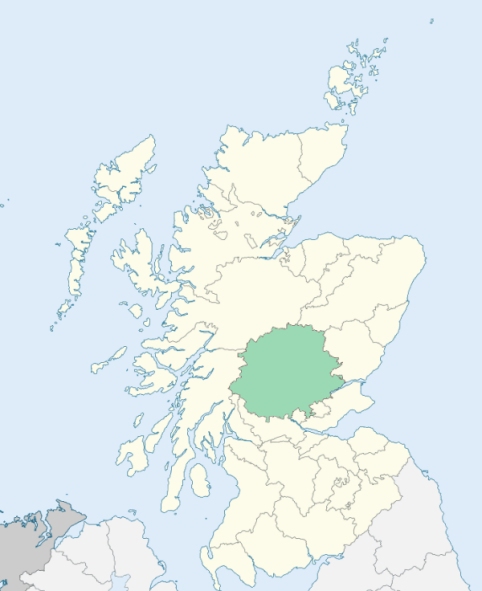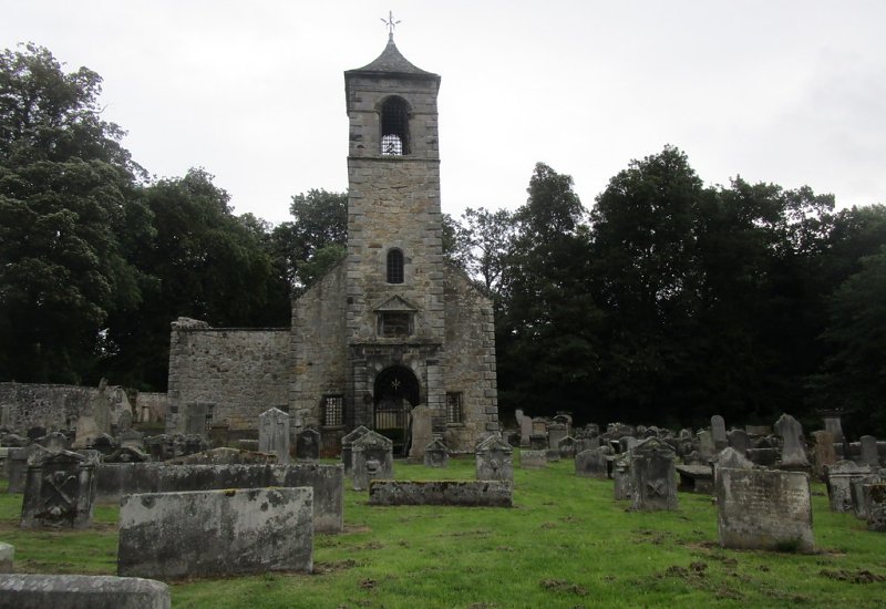
Tulliallan is a parish in the detached district of Perthshire. It is bounded on the south-west and south by the Firth of Forth, and on other sides by the parishes of Culross and Clackmannan. (1867: The Imperial Gazetteer of Scotland, by John Marius Wilson).
Kincardine, Longannat, Tulliallan
The parishes of Culross and Tulliallan formed a detached part of Perthshire, lying on the Forth between the counties of Clackmannan and Fife. They have now been transferred to the county of Fife. See affected properties and landholders. (1892: Boundary of counties and parishes in Scotland as settled by the Boundary Commissioners under the Local Government Act, 1889, by Hay Shennan)
PRE-REFORMATION GOVERNANCE:
POST-REFORMATION GOVERNANCE:
This was of old a small parish consisting only of the barony of Tulliallan. In 1673 there were added to it the barony of Kincardine-on-Forth, and the lands of Lurg, Sands, and Kellywood, all taken from the parish of Culross.
Includes ministers, licentiates, assistants, readers, and clerks.
(1928: Fasti Ecclesiæ Scoticanæ, by Hew Scott, D. D.)
Parish registers turned over to the Registrar-General, as a result of the Registration of Births, Deaths, and Marriages (Scotland) Act of 1854. The letters B. D. and M. indicate Births (or Baptisms), Deaths (or Burials), and Marriages (or Proclamations of Banns) respectively. Numbers indicate separate volumes or books. Note: These records are by no means complete or without damage; consult the Detailed List of the Old Parochial Registers of Scotland (1872) to learn more about the condition of the records.
| OPR and RD Numbers | |||
|---|---|---|---|
| Date Range | Name | Number | Type |
| 1673-1854 | Tulliallan, Perth | 397 | OPR |
| 1855-1892 | Tulliallan, Fife | 397 | RD |
| 1893-1967 | Tulliallan | 458b | RD |
| 2009 | Fife, West Fife | 435 | RD |
| 2026 | Fife Council; Kincardine Community Council | ||
(2009: Parishes and Registration Districts of Scotland - Old and New, National Records of Scotland)
Local community councils (2026) are provided as a potential source of additional information for settlements within the original boundaries of the parish. (Source)
Statistics from informal and official censuses
Angus, Drysdale, Ferguson, Finlayson, Hunter, Mercer, Millar, Paterson, Wilson, Young
Note: Names appearing in research materials, other than censuses. Simple names (First name, surname only) have been omitted unless they appear associated with large properties. All women's names, and men's names with occupations, military ranks, or peerage titles are included.
By the Reverend Mr David Simson, Minister.
"The number of souls at present (1793), in the parish is 2430. There are 2040 members of the Established Church, 370 Burgher Seceders and 16 Antiburgher Seceders.
Kincardine is a pretty large village on the banks of the Forth, containing 312 houses, substantially built, and are generally finished neatly in the inside. A considerable number of them consist of two, and some of them, of three flats. There are 4 mills in this parish, within 40 yards of each other, built in a most substantial manner; viz. a meal, a barley, a flour, and a threshing mill, all driven by the same water. There are two large distilleries in this place, which feed annually from 170 to 200 cattle. They employ a great many servants and horses, besides what they hire. Their spirits go to the Fife, Edinubugh, and Glasgow markets. No manufactures, excepting ship building, which has been carried on successively for above 50 years past have been introduced into Kincardine, until within these two years, that two companies for tambouring have settled in it, who employ about 50 girls each, and 18 looms. The other mechanics are employed in working to the people of the parish."
(This section contains excerpts, at times restructured or paraphrased, from an article appearing in Statistical Account of Scotland, Sir John Sinclair, 1791-1799)
Primary Sources:
Statistical Account of Scotland (1791-1799), Volume 11, p. 546
New Statistical Account of Scotland (1834-1845), Volume 10, p. 867
See Parish Page Sources for all source information and links.