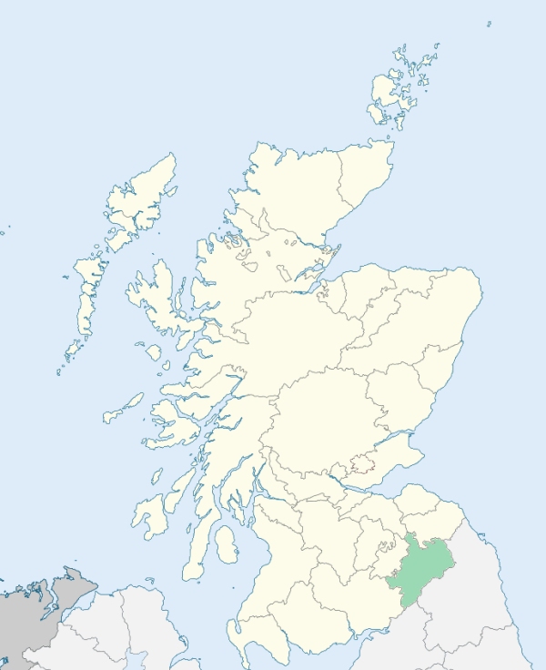
Roxburgh is a parish in the lower part of Teviotdale, Roxburghshire. It is bounded by the parishes of Makerston, Kelso, Eckford, Crailing, Ancrum, and Maxton. (1867: The Imperial Gazetteer of Scotland, by John Marius Wilson).
Heiton, Roxburgh
Sunlaws
PRE-REFORMATION GOVERNANCE:
POST-REFORMATION GOVERNANCE:
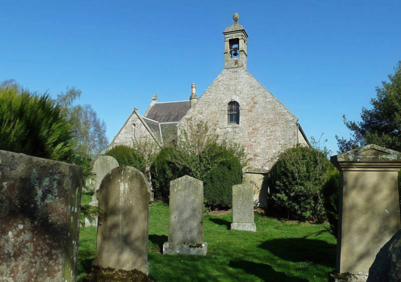
Between 1153 and 1160 Malcolm IV granted "to the Church of St Mungo of Glasgow and to Bishop Herbert and his successors, the Church of Auld Roxburgh ... as Ascellin the Archdean held it in the time of King David." A church erected in the 1752 has undergone various alterations. The old church was dedicated to the Holy Sepulchre. Just outside the royal burgh of Roxburgh and in this parish, stood St Peter's Priory of the Grey Friars. Also in this parish was St Magdalene's Hospital.
Includes ministers, licentiates, assistants, readers, and clerks.
(1928: Fasti Ecclesiæ Scoticanæ, by Hew Scott, D. D.)
Parish registers turned over to the Registrar-General, as a result of the Registration of Births, Deaths, and Marriages (Scotland) Act of 1854. The letters B. D. and M. indicate Births (or Baptisms), Deaths (or Burials), and Marriages (or Proclamations of Banns) respectively. Numbers indicate separate volumes or books. Note: These records are by no means complete or without damage; consult the Detailed List of the Old Parochial Registers of Scotland (1872) to learn more about the condition of the records.
| OPR and RD Numbers | |||
|---|---|---|---|
| Date Range | Name | Number | Type |
| 1624-1854 | Roxburgh | 803 | OPR |
| 1855-1967 | Roxburgh | 803 | RD |
| 2009 | Scottish Borders, Kelso | 821 | RD |
| 2026 | Scottish Borders Council; Heiton and Roxburgh Community Council | ||
(2009: Parishes and Registration Districts of Scotland - Old and New, National Records of Scotland)
Local community councils (2026) are provided as a potential source of additional information for settlements within the original boundaries of the parish. (Source)
Statistics from informal and official censuses
Gray, Henderson, Hendry, Kerr, Robertson, Scott, Thomson, Turnbull, Waldie, Wilson
Note: Names appearing in research materials, other than censuses. Simple names (First name, surname only) have been omitted unless they appear associated with large properties. All women's names, and men's names with occupations, military ranks, or peerage titles are included.
By the Reverend Mr Andrew Bell, Minister of the Parish.
"Vestiges of villages, malt steeps, cottages, and other memorials of inhabitation in various parts of the parish, indicate the population to have been formerly very considerable; but no exact list of old date having fallen into my hands, the number cannot be ascertained far back. Agreeably to a practice recommended and generally observed in the Church of Scotland, the writer, upon his induction to this cure (1781), visited every family within its bounds, and found the number of souls in the parish to be upwards of 1050.
A very accurate list was again made out at the desire of the Sheriff of the county, in 1782, to assist in providing against a scarcity, with which this country was then threatened, and the number of souls was found to be 1100. They do not at present exceed 900, and may be distributed thus: 480 of the Established Church; 170 Burghers, Antiburghers, and Relief Seceders, 9 Cameronians and Quakers. There are 360 males, 540 females, 251 children, 191 families or householders.
There are 121 cotters, 23 hinds and herds, 43 handicraftsmen, 7 apprentices to handicraftsmen, 60 male servants, 46 female servants, and 22 farmers. The great disproportion between the males and females seems to arise from a number of cot-houses being possessed by women, whose husbands or sons are employed elsewhere.
An unexampled flow of prosperity has, of late years, wonderfully altered the condition, sentiments, and manners of men in this corner of the country; but the writer is happy to find the people here retain, in general, their wonted character of sobriety, kindness, liberality, and respect for the ordinances of divine worship."
(This section contains excerpts, at times restructured or paraphrased, from an article appearing in Statistical Account of Scotland, Sir John Sinclair, 1791-1799)
Primary Sources:
Statistical Account of Scotland (1791-1799), Volume 19, p. 114
New Statistical Account of Scotland (1834-1845), Volume 3, Section I, p. 127
See Parish Page Sources for all source information and links.