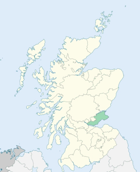
Abbotshall is a parish on the southern border of Fife. It is bounded by the Firth of Forth, and by the parishes of Kinghorn, Auchtertool, Auchterderran, Dysart, and Kirkcaldy. (1867: The Imperial Gazetteer of Scotland, by John Marius Wilson).
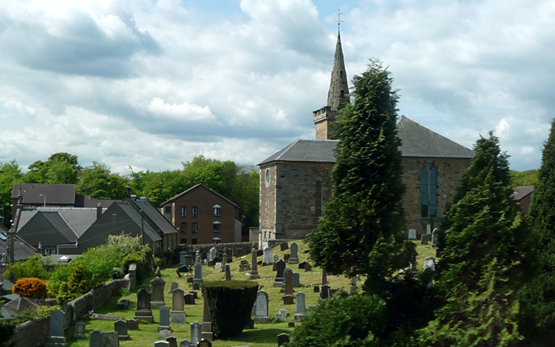
Chapel, Linktown
Raith
The parish of Abbotshall had two detached parts (respectively 27 acres and 4 acres in extent), both of which were wholly surrounded by the parish of Kirkcaldy. These two detached parts were annexed to Kirkcaldy parish. See affected properties and landholders. (1892: Boundary of counties and parishes in Scotland as settled by the Boundary Commissioners under the Local Government Act, 1889, by Hay Shennan)
PRE-REFORMATION GOVERNANCE:
POST-REFORMATION GOVERNANCE:
The parish of Abbotshall was disjoined from Kirkcaldy and Kinghorn in 1650. The Abbot of Dunfermline had a mansion here, which has given its name to the parish.
Disjoined Quoad Sacra Parishes:
Invertiel. There was of old at Invertiel a chapel of St Katherine. In 1836 a mission chapel was built here. The parish of Invertiel was disjoined from Kinghorn and Abbotshall, 19 July 1869.
Raith. A church was purchased at Linktown in 1875 and mission services begun. The parish of Raith was disjoined from Abbotshall on 25 February 1884.
(1928: Fasti Ecclesiæ Scoticanæ, by Hew Scott, D. D.)
Includes ministers, licentiates, assistants, readers, and clerks.
Abbotshall (QO)
Invertiel (QS)
Raith (QS)
(1928: Fasti Ecclesiæ Scoticanæ, by Hew Scott, D. D.)
Parish registers turned over to the Registrar-General, as a result of the Registration of Births, Deaths, and Marriages (Scotland) Act of 1854. The letters B. D. and M. indicate Births (or Baptisms), Deaths (or Burials), and Marriages (or Proclamations of Banns) respectively. Numbers indicate separate volumes or books. Note: These records are by no means complete or without damage; consult the Detailed List of the Old Parochial Registers of Scotland (1872) to learn more about the condition of the records.
| OPR and RD Numbers | |||
|---|---|---|---|
| Date Range | Name | Number | Type |
| 1650-1854 | Abbotshall | 399 | OPR |
| 1855-1874 | Abbotshall | 399 | RD |
| 1875-1919 | Kirkcaldy and Abbotshall | 442 | RD |
| 2009 | Fife, Kirkcaldy | 421 | RD |
| 2026 | Fife Council; Kirkcaldy West Community Council | ||
(2009: Parishes and Registration Districts of Scotland - Old and New, National Records of Scotland)
Local community councils (2026) are provided as a potential source of additional information for settlements within the original boundaries of the parish. (Source)
Statistics from informal and official censuses
Anderson, Black, Brown, Chalmers, Gourlay, Henderson, Mitchell, Robertson, Watson, Wilson
Note: Names appearing in research materials, other than censuses. Simple names (First name, surname only) have been omitted unless they appear associated with large properties. All women's names, and men's names with occupations, military ranks, or peerage titles are included.
By the Reverend Mr George Shaw.
"In 1791, the total population is 2136; males 1061, females 1075. The number of inhabitants in the town is 1660, in the country 476. There are 25 farmers, their families about 200; 8 principal manufacturers, besides a few smaller ones; 50 apprentices, 10 or 12 seamen, 63 male household servants; 60 female household servants, 12 merchants. The great bulk of the inhabitants are tradesmen, being wholly employed in manufactures. The number of the Established Church 1338, of Seceders 98.
In the town are 3 principal manufactures, under the name of Checks and Bed-tikes. These employ between 200 and 300 looms in the parish, and a great number in the parishes around. Two of these have each an extensive bleachfield near by, where they whiten their own yarn. There are besides 5 cotton manufactures of the name of the Spinning Jeanies, the heavy parts of which are driven by a horse-engine. These employ near 200 hands, several of whom are children, &c.
In general, the people are of the middle size. The greatest height which any have attained, is about 6 feed 2 inches. They are very much disposed to industry."
(This section contains excerpts, at times restructured or paraphrased, from an article appearing in Statistical Account of Scotland, Sir John Sinclair, 1791-1799)
Primary Sources:
Statistical Account of Scotland (1791-1799), Volume 4, p. 185
New Statistical Account of Scotland (1834-1845), Volume 9, Section I, p. 146
See Parish Page Sources for all source information and links.