Eaglais Ninian, Eccles, St Ringan's
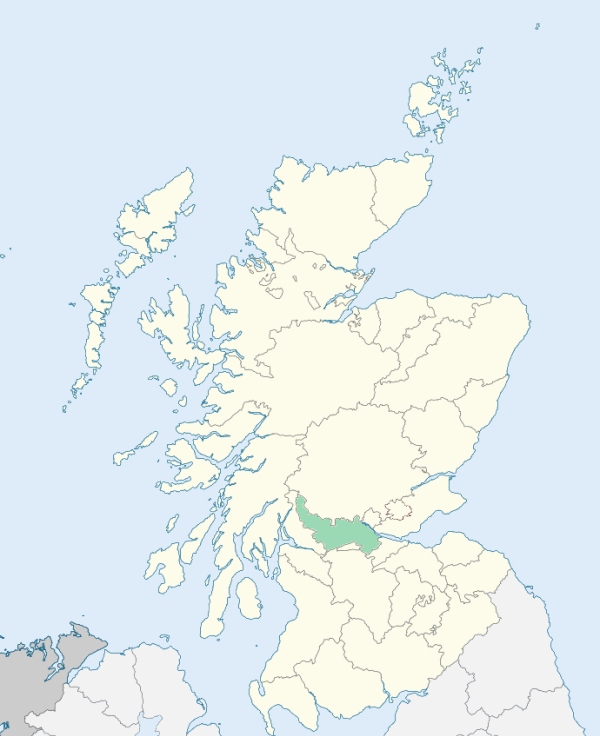
St Ninians is a large parish in the central part of Stirlingshire. It is bounded on the north by Kincardine, Lecropt, Stirling, Logie, and Alloa, on the east by Airth, on the south by Larbert, Dunipace, Denny, and Kilsyth, on the south-west by Fintry, and on the west and north-west by Gargunnock. (1867: The Imperial Gazetteer of Scotland, by John Marius Wilson).
Auchenbowie, Bannockburn, Belfield or Bellfield, Blackbraes, Buckieburn, Cambusbarron, Camp, Cauldhame, Chartershall, Craigford, Damhead, Greenyards, Linlithgow Bride, Maddiston, Milton Bog, Muiralehouse or Muirton, Newhouse, Newmarket, Plean, St Ninians or Kirkton, Standrigg, Torbrex, Whins of Milton
Auchenbowie, Carnock, Craigengelt, Murrayshall, Sauchie, Touch House
The parish of St Ninians had three detached parts, all situated within the parliamentary limits of the burgh of Stirling, and all, either wholly or partly, surrounded by the parish of Stirling. In order to adjust the boundaries of the two parishes, certain exchanges of territory have been made. See affected properties and landholders. (1892: Boundary of counties and parishes in Scotland as settled by the Boundary Commissioners under the Local Government Act, 1889, by Hay Shennan)
PRE-REFORMATION GOVERNANCE:
POST-REFORMATION GOVERNANCE:
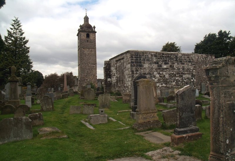
Previously called Eaglais Niniain, the church of this parish was dedicated to St Ninian. It belonged to the Abbey of Cambuskenneth. It was mainly within the bounds of St Ninians that the Battle of Bannockburn was fought in 1314. This parish contained of old four chapels, at St Ninian's Well, Skeoch, Cambusbarron, and the Kirk o' Muir. Close to Stirling, but in St Ninians Parish, stood a House of the Black Friars. At Buckieburn, within the bounds, there is a mission chapel.
Disjoined Quoad Sacra Parishes:
Bannockburn. A chapel was built here in 1838. The parish of Bannockburn was disjoined from St Ninians on 17 July 1867. There is a mission chapel within the bounds at Fallin.
Plean. A chapel was built here in 1839. The parish of Plean was disjoined from St Ninians on 17 March 1879.
Includes ministers, licentiates, assistants, readers, and clerks.
St Ninians (QO)
Bannockburn (QS)
Plean (QS)
(1928: Fasti Ecclesiæ Scoticanæ, by Hew Scott, D. D.)
Parish registers turned over to the Registrar-General, as a result of the Registration of Births, Deaths, and Marriages (Scotland) Act of 1854. The letters B. D. and M. indicate Births (or Baptisms), Deaths (or Burials), and Marriages (or Proclamations of Banns) respectively. Numbers indicate separate volumes or books. Note: These records are by no means complete or without damage; consult the Detailed List of the Old Parochial Registers of Scotland (1872) to learn more about the condition of the records.
| OPR and RD Numbers | |||
|---|---|---|---|
| Date Range | Name | Number | Type |
| 1643-1854 | St Ninians | 488 | OPR |
| 1855-1871 | St Ninians | 488 | RD |
| 1872-1969 | St Ninians | 488-1 | RD |
| 1872-1908 | Bannockburn | 488-2 | RD |
| 1909-1969 | Cambusbarron | 488-2 | RD |
| 2009 | (St Ninians) Stirling | 473 | RD |
| 2009 | (Bannockburn) Stirling | 490 | RD |
| 2009 | (Cambusbarron) Stirling | 473 | RD |
| 2026 | (St Ninians) Stirling Council; St Ninians Community Council | ||
| 2026 | (Bannockburn) Stirling Council; Bannockburn Community Council | ||
| 2026 | (Cambusbarron) Stirling Council; Cambusbarron Community Council | ||
(2009: Parishes and Registration Districts of Scotland - Old and New, National Records of Scotland)
Local community councils (2026) are provided as a potential source of additional information for settlements within the original boundaries of the parish. (Source)
Statistics from informal and official censuses
Brown, Campbell, Forsyth, Miller, Paterson, Robertson, Smith, Stevenson, Stewart, Taylor
Note: Names appearing in research materials, other than censuses. Simple names (First name, surname only) have been omitted unless they appear associated with large properties. All women's names, and men's names with occupations, military ranks, or peerage titles are included.
By the Reverend Mr William Sheriff.
"In 1792 the population amounted to 7079. It is beyond a doubt, that the population of the parish is increasing. The decrease of population by the uniting of farms in the country, is more than compensated by the increase of the inhabitants in the villages.
We have several merchants who retail the articles of ordinary consumption. We have no great manufactories. Four tanneries employ about 20 hands. Four masters employ about 113 hands in making nails. One hand works from 1000 to 1200 nails per day. The most considerable manufacture is carried on at Bannockburn. Of late cotton-cloth, and for a long time, all the tartan used by the army, has been manufactured at this village. There are three coal-works in the parish; one at Auchenbowie, one at Pleanmuir, one at Bannockburn. From 50 to 100 hands are usually employed in malting, and in distilling aquavitae. There are at least 6 distilleries in the parish. Some of them at present (November 1794) are not employed."
(This section contains excerpts, at times restructured or paraphrased, from an article appearing in Statistical Account of Scotland, Sir John Sinclair, 1791-1799)
Primary Sources:
Statistical Account of Scotland (1791-1799), Volume 18, p. 385
New Statistical Account of Scotland (1834-1845), Volume 8, Section II, p. 303
See Parish Page Sources for all source information and links.