Libberton and Quothquan
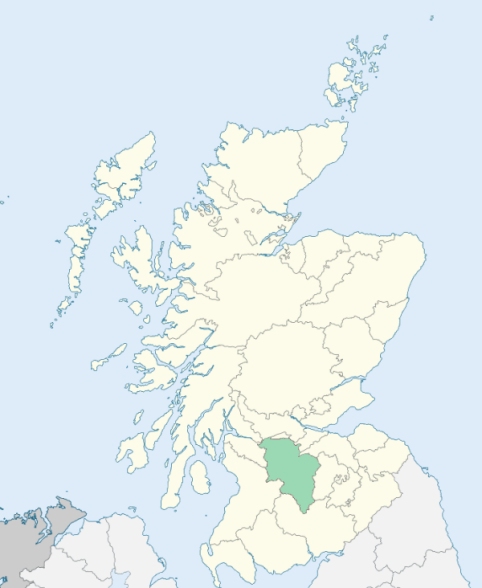
Libberton is a parish in the upper ward of Lanarkshire. It is bounded by the parishes of Carnwath, Walston, Biggar, Symington, Covington, and Pettinain. (1867: The Imperial Gazetteer of Scotland, by John Marius Wilson).
Libberton, Quothquan
Huntfield, Shieldhill
PRE-REFORMATION GOVERNANCE:
POST-REFORMATION GOVERNANCE:
Libberton. United to Quothquan in 1618, and disjoined by agreement between the patron and Presbytery, 3 Feb 1649.
Quothquan. United to Libberton in 1648, and disjoined 3 Feb 1649. The disjunction was recalled, 27 Jan 1669.
Includes ministers, licentiates, assistants, readers, and clerks.
Libberton (QO)
Quothquan (QO)
(1928: Fasti Ecclesiæ Scoticanæ, by Hew Scott, D. D.)
Parish registers turned over to the Registrar-General, as a result of the Registration of Births, Deaths, and Marriages (Scotland) Act of 1854. The letters B. D. and M. indicate Births (or Baptisms), Deaths (or Burials), and Marriages (or Proclamations of Banns) respectively. Numbers indicate separate volumes or books. Note: These records are by no means complete or without damage; consult the Detailed List of the Old Parochial Registers of Scotland (1872) to learn more about the condition of the records.
| OPR and RD Numbers | |||
|---|---|---|---|
| Date Range | Name | Number | Type |
| 1717-1854 | Libberton | 650 | OPR |
| 1855-1965 | Libberton | 650 | RD |
| 2009 | South Lanarkshire, Biggar | 584 | RD |
| 2026 | South Lanarkshire Council; Black Mount Community Council Quothquan and Thankerton Community Council | ||
(2009: Parishes and Registration Districts of Scotland - Old and New, National Records of Scotland)
Local community councils (2026) are provided as a potential source of additional information for settlements within the original boundaries of the parish. (Source)
Statistics from informal and official censuses
Fram, Gibson, Lawrie, Lindsay, Moffat, Muir, Ritchie, Walker, Watson, Wilson
Note: Names appearing in research materials, other than censuses. Simple names (First name, surname only) have been omitted unless they appear associated with large properties. All women's names, and men's names with occupations, military ranks, or peerage titles are included.
By the Reverend Mr John Fraser.
"At present, the males in the parish amount to 370; the females to 380, which makes the whole number of inhabitants 750. Of these, none reside in towns or villages, there being none in the parish, except that of Libberton, which scarcely deserves the name of a village, as it only consists of a few scattered huts. Of the 750 souls in this parish, there are 109 under the age of 10. There are, at present in the parish, 125 married men, widowers included, and 28 bachelors. Among the bachelors are included all above 22 years of age. The number of inhabited houses, is exactly 168.
The number of professed farmers, in the parish, amount to 40. With their children and servants, they amount to 198. There are 6 apprentices in the parish, 100 labouring servants male and female, and 1 surgeon. The Seceders, of all denominations, amount to 98.
The people in this parish are very economical, and far from being expensive or luxurious for their circumstances, except in the use of tobacco. Smoking is almost universally practised among both men and women. The people of this parish enjoy, upon the whole, a considerable share of the comforts and advantages of life; and, from their outward appearance, they seem to be contented with their situation."
(This section contains excerpts, at times restructured or paraphrased, from an article appearing in Statistical Account of Scotland, Sir John Sinclair, 1791-1799)
Primary Sources:
Statistical Account of Scotland (1791-1799), Volume 2, p. 233
New Statistical Account of Scotland (1834-1845), Volume 6, p. 41
See Parish Page Sources for all source information and links.