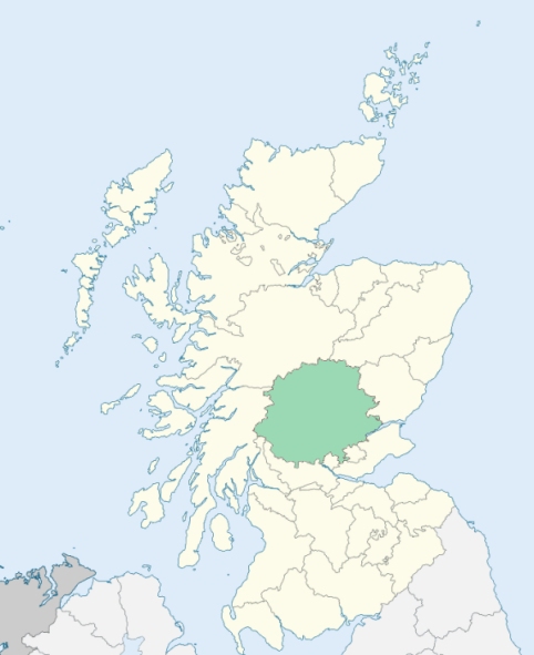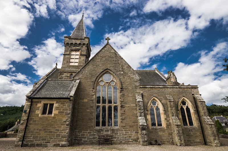
Caputh is a parish partly in Forfarshire, but chiefly in Perthshire. It consists of a main body and several detached districts. The main body lies wholly within the Stormont district of Perthshire. It is bounded by the parishes of Dunkeld, Clunie, Lethendy, Blairgowrie, Kinclaven, Auchtergaven, and Little Dunkeld. (1867: The Imperial Gazetteer of Scotland, by John Marius Wilson).
Butterstone, Caputh, Caputh Wester, Craigie, Fungarth, Kincairney or Kincairnie, Lower Hatton, Meikleour, Spittal Field or Spittalfield
Ballied, Dalrulzian, Delvine, Drummellie, Easter Logie, Forneth, Glendelvine, Gormacks, Gourdie, Hillhead, Kincairney, Mylnefield, Snaigow
(1) The parish of Tealing had a detached part, situated at Pitpointie, and bounded on the east by the detached part of Caputh situated at Balbeuchly, and elsewhere by the parish of Auchterhouse. This detached part of Caputh was the only part of Caputh which belonged to the county of Forfar. Both of these detached parts have been transferred to the parish of Auchterhouse.
See affected properties and landholders. (1892: Boundary of counties and parishes in Scotland as settled by the Boundary Commissioners under the Local Government Act, 1889, by Hay Shennan)
(2) Whereas part of the parish of Kettins and of the county of Forfar, extending to 335 acres or thereby, situated at or near Bandirran, and adjoining the parishes of Caputh in the county of Perth is detached from the main portion of the said parish of Kettins and of the county of Forfar:
And whereas a part of the parish of Caputh, extending to 237 acres or thereby, situated at or near South Bandirran and adjoining the parishes of Kilspindie and Kinnaird and the aforesaid detached part of the parish of Kettins (being the part marked on the Ordnance Survey maps Caputh detached No. 3), is detached from the main portion of the parish of Caputh:
I. The aforesaid detached part of the parish of Kettins and of the county of Forfar shall cease to be part of the said parish and of the said county, and shall form part of the parish of Collace and of the county of Perth.
II. The aforesaid detached part of the parish of Caputh shall cease to be part of that parish, and shall form part of the parish of Collace.
See affected properties and landholders. (1892: Boundary of counties and parishes in Scotland as settled by the Boundary Commissioners under the Local Government Act, 1889, by Hay Shennan)
(3) Whereas part of the parish of Caputh and of the county of Perth, containing 283 acres or thereby, situated at or near Foffarty and adjoining the parishes of Glamis, Inverarity, and Kinnettles, in the county of Forfar (being the part marked on the Ordnance Survey maps Caputh detached No. 5) is detached from the main portion of the parish of Caputh and of the county of Perth:
And whereas part of the parish of Caputh and of the county of Perth, containing half an acre or thereby, situated at Broughty Castle, and adjoining the parish of Monifieth in the county of Forfar, is detached from the main portion of the parish of Caputh and of the county of Perth:
I. The aforesaid detached part of the parish of Caputh and of the county of Perth, marked on the Ordnance Survey maps Caputh detached No. 5, shall cease to be part of the said parish and county, and shall form part of the parish of Kinnettles and of the county of Forfar.
II. The aforesaid detached part of the parish of Caputh and of the county of Perth, situated at or near Broughty Castle, shall cease to be part of the said parish and county, and shall form part of the parish of Monifieth and of the county of Forfar.
See affected properties and landholders. (1892: Boundary of counties and parishes in Scotland as settled by the Boundary Commissioners under the Local Government Act, 1889, by Hay Shennan)
(4) A detached part of Clunie was transferred to the parish of Caputh. A detached part of Caputh was annexed to Clunie, and the part of Caputh which lies north-east of the western march of the estate of Gourdie was also annexed to Clunie. See affected properties and landholders. (1892: Boundary of counties and parishes in Scotland as settled by the Boundary Commissioners under the Local Government Act, 1889, by Hay Shennan)
(5) The parish of Dunkeld and Dowally had two detached parts:
No. 1. Dalcapon, nearly surrounded by the parish of Logierait
No. 2. Dowally, being the old parish of Dowally
(a.) Dunkeld and Dowally detached No. 1 was transferred to the parish of Logierait.
(b.) Part of the parish of Caputh was annexed to Dunkeld and Dowally, and in this way the main portion and detached No. 1 of the parish of Dunkeld and Dowally were united. See affected properties and landholders. (1892: Boundary of counties and parishes in Scotland as settled by the Boundary Commissioners under the Local Government Act, 1889, by Hay Shennan)
PRE-REFORMATION GOVERNANCE:
POST-REFORMATION GOVERNANCE:
The parishes of Caputh and Logie Mached were united in the sixteenth century.
Caputh. The Bishop of Dunkeld disjoined the parish of Caputh from Little Dunkeld in or about 1500. Caputh was a mensal parish of the Bishop. Within the bounds there was a chapel of St Ewan.
Logie Mached, or Logie Madaich. This parish was a prebend of Dunkeld. Its church was dedicated to St Jerome.
Includes ministers, licentiates, assistants, readers, and clerks.
(1928: Fasti Ecclesiæ Scoticanæ, by Hew Scott, D. D.)
Parish registers turned over to the Registrar-General, as a result of the Registration of Births, Deaths, and Marriages (Scotland) Act of 1854. The letters B. D. and M. indicate Births (or Baptisms), Deaths (or Burials), and Marriages (or Proclamations of Banns) respectively. Numbers indicate separate volumes or books. Note: These records are by no means complete or without damage; consult the Detailed List of the Old Parochial Registers of Scotland (1872) to learn more about the condition of the records.
| OPR and RD Numbers | |||
|---|---|---|---|
| Date Range | Name | Number | Type |
| 1671-1854 | Caputh | 337 | OPR |
| 1855-1968 | Caputh | 337 | OPR |
| 2009 | Perth and Kinross, Blairgowrie | 381 | RD |
| 2026 | Perth and Kinross Council; Spittalfield and District Community Council | ||
(2009: Parishes and Registration Districts of Scotland - Old and New, National Records of Scotland)
Local community councils (2026) are provided as a potential source of additional information for settlements within the original boundaries of the parish. (Source)
Statistics from informal and official censuses
Campbell, Cuthbert, Duff, Reid, Robertson, Scott, Smith, Stewart, Thomson, Young
Note: Names appearing in research materials, other than censuses. Simple names (First name, surname only) have been omitted unless they appear associated with large properties. All women's names, and men's names with occupations, military ranks, or peerage titles are included.
By the Reverend Mr William Innerarity.
"The first enumeration of the inhabitants made by the present incumbent, was from June 1784 to April 1785, when the number of souls was 2023. In the list made from November 1791 to October 1792; the numbers were 2045, of whom 985 were male and 1060 female. Of the Established Church 1974, Episcopalians 27, Antiburgher Seceders 39, Roman Catholics 2, of the Relief Congregation 3.
There are 130 weavers, 24 masons, 30 wrights, 1 boat-wright, 2 wheel-wrights, 8 boatmen, 12 shoemakers, 19 tailors, 10 blacksmiths, 3 coopers, 7 millers, 47 day-labourers, 4 alehouse-keepers, 2 distillers, 4 shopkeepers, 10 flax-dressers, and 7 gardeners. There are 456 inhabited houses, that is, separate dwellings; of which 411 are inhabited by married, widowers, and widows, and 45 by unmarried of either sex. There are five townships or villages, containing from 20 to 38 families; and 6 containing from 7 to 17 families. Meiklour, the largest of them, has 3 fairs for cattle in the year.
The people here have an indifference, and even dislike, both to a seafaring and a military life. They prefer the occupations in husbandry or manufacture, to which they are inured from their infancy. They are rather fond of large weddings and funerals, and often incur unnecessary expense on such occasions. Of late, they have become much more studious of dress than they were, and have changed for the better their mode of living in many articles of domestic economy. They are now more attentive to cleanliness than formerly; their cottages are more substantially and commodiously built; and their condition is daily improving.
On the whole they are sober, peaceable and industrious. They are in general humane to one another, and show great kindness and sympathy to their distressed neighbours. During the last 30 years, one instance of suicide has happened; and one person has been banished. I have not heard of any person belonging to the parish having suffered capital punishment."
(This section contains excerpts, at times restructured or paraphrased, from an article appearing in Statistical Account of Scotland, Sir John Sinclair, 1791-1799)
Primary Sources:
Statistical Account of Scotland (1791-1799), Volume 9, p. 485
New Statistical Account of Scotland (1834-1845), Volume 10, p. 670
See Parish Page Sources for all source information and links.