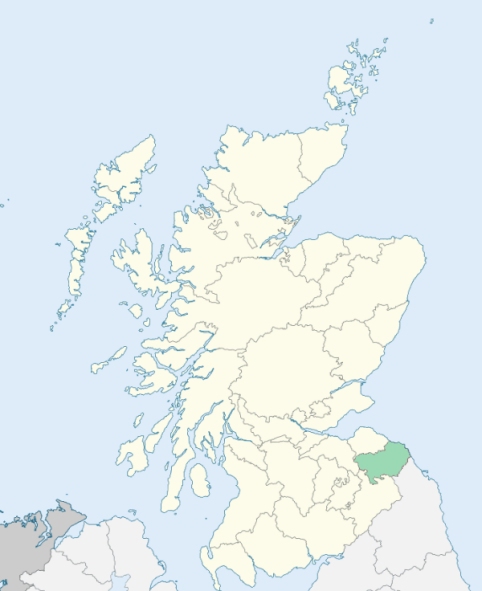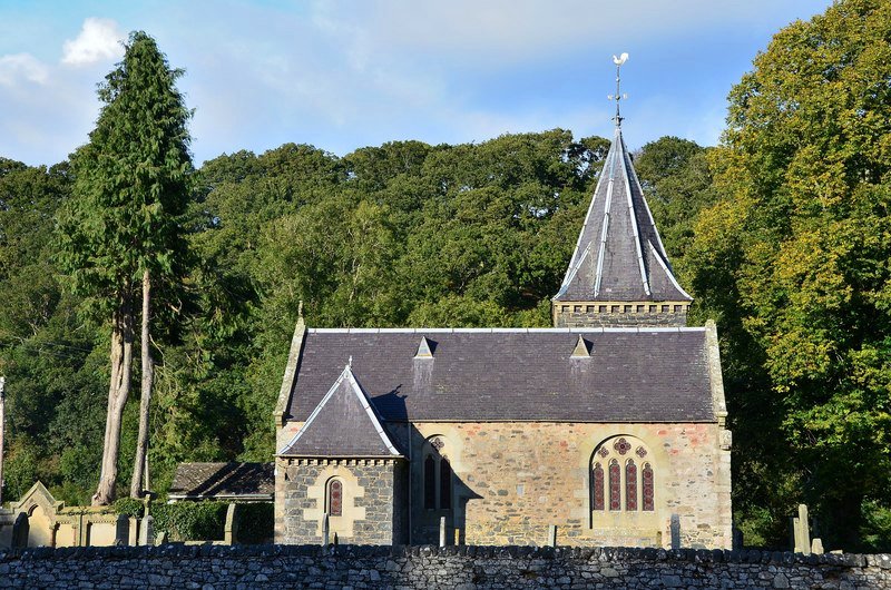
Abbey St Bathans is a parish in the Lammermoor district of Berwickshire. It is bounded by Haddingtonshire, and by the parishes of Cockburnspath, Coldingham, Bunkle, Longformacus, Duns, and Oldhamstocks. (1867: The Imperial Gazetteer of Scotland, by John Marius Wilson).
Abbey St Bathans, Kirkton
The parish of Abbey St Bathans had two detached parts, one of which lay to the north of the main portion of the parish within the parish of Cockburnspath, while the other was separated from the main portion of the parish by a detached part of the parish of Longformacus. The first of these detached parts was transferred to the parish of Cockburnspath. The second of these detached parts was united with the main portion of the parish of Abbey St Bathans by the transference to that parish of the detached part of Longformacus. See affected properties and landholders. (1892: Boundary of counties and parishes in Scotland as settled by the Boundary Commissioners under the Local Government Act, 1889, by Hay Shennan)
PRE-REFORMATION GOVERNANCE:
POST-REFORMATION GOVERNANCE:
The parishes of Abbey St Bathans and Strafontain were united soon after the Reformation.
Abbey St Bathans. Abbey St Bathans is named from its patron, Saint Bathan, second Abbot of Iona. There being a better known church of St Bathan at Yester, this one came to be called Abbey St Bathans, i.e. St Bathans belonging to the Abbey of Dryburgh, which had extensive possessions in the neighbourhood. Towards the end of the thirteen century, Ada, Countess of Dunbar, a natural daughter of William the Lion, founded here a priory of Cistercian nuns, dedicated to St Mary.
Strafontain. Strafontain, or Trefontaine, was evidently dedicated to St Fintan. Its two names are formed from his, with the Cymric words Ystred and tref, both meaning hamlet (Ystred Fintain = Strafontain, Tref Fintain = Trefontaine). In 1218 the hospital of Godscroft was founded near the church of Strafontain. In 1450 Strafontain was made a prebend of the Collegiate Church of St Mary at Dunglass.
Includes ministers, licentiates, assistants, readers, and clerks.
(1928: Fasti Ecclesiæ Scoticanæ, by Hew Scott, D. D.)
Parish registers turned over to the Registrar-General, as a result of the Registration of Births, Deaths, and Marriages (Scotland) Act of 1854. The letters B. D. and M. indicate Births (or Baptisms), Deaths (or Burials), and Marriages (or Proclamations of Banns) respectively. Numbers indicate separate volumes or books. Note: These records are by no means complete or without damage; consult the Detailed List of the Old Parochial Registers of Scotland (1872) to learn more about the condition of the records.
| OPR and RD Numbers | |||
|---|---|---|---|
| Date Range | Name | Number | Type |
| 1715-1854 | Abbey St Bathans | 726 | OPR |
| 1855-1966 | Abbey St Bathans | 726 | RD |
| 2009 | Scottish Borders, Duns | 785 | RD |
| 2026 | Scottish Borders Council; Abbey St Bathans, Bonkyl and Preston Community Council | ||
(2009: Parishes and Registration Districts of Scotland - Old and New, National Records of Scotland)
Local community councils (2026) are provided as a potential source of additional information for settlements within the original boundaries of the parish. (Source)
Statistics from informal and official censuses
Aitchison, Brown, Ferguson, Fullerton, Hope, Hunter, Johnston, Mack, Richardson, Smith
Note: Names appearing in research materials, other than censuses. Simple names (First name, surname only) have been omitted unless they appear associated with large properties. All women's names, and men's names with occupations, military ranks, or peerage titles are included.
By the Reverend Mr John Sked.
"There are at present 164 inhabitants in the parish, of whom 85 are males, and 79 females; all of whom, except a few mechanics, are employed in purposes of husbandry, either as day-labourers, hired servants to farmers, or shepherds. They are in general sober, frugal, and industrious, and are contented with their situation."
(This section contains excerpts, at times restructured or paraphrased, from an article appearing in Statistical Account of Scotland, Sir John Sinclair, 1791-1799)
Primary Sources:
Statistical Account of Scotland (1791-1799), Volume 12, p. 61
New Statistical Account of Scotland (1834-1845), Volume 2, Section III, p. 105
See Parish Page Sources for all source information and links.